We are in the process of migrating all NASA Earth science data sites into Earthdata from now until end of 2026. Not all NASA Earth science data and resources will appear here until then. Thank you for your patience as we make this transition.
Read about the Web Unification Project
Filters
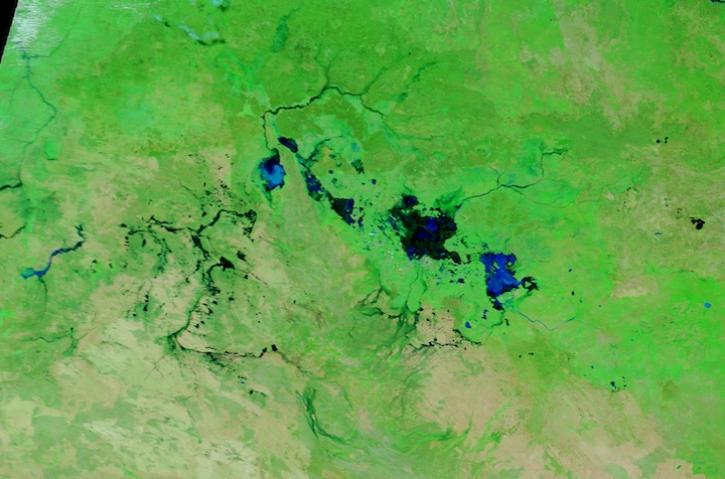
Image captured March 13, 2024, by the MODIS instrument aboard NASA's Terra satellite.
Worldview Image of the Week
March 14, 2024

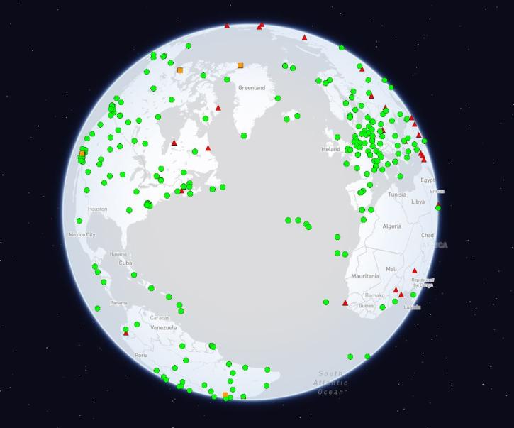
SWOT presents opportunities and challenges in characterizing sea surface height anomalies.
Data in Action
March 14, 2024
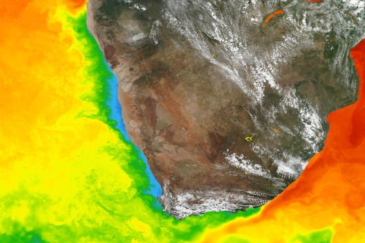
Base image captured March 5, 2024, by the Visible Infrared Imaging Radiometer Suite (VIIRS) instrument aboard the Suomi NPP satellite, overlaid with sea surface temperature.
Worldview Image of the Week
March 7, 2024
This Understanding Needs to Broaden Outside Use of NASA Data (UNBOUND) workshop connected coastal zone groups with key NASA data.
News
March 7, 2024

A summary of datasets, products, and resources released by NASA’s Distributed Active Archive Centers (DAACs) in Feb 2024.
News
March 4, 2024

Organized by the Airborne and Field Data Working Group, the Second Airborne and Field Data Workshop gathered input to improve the usability of airborne and field data, with a focus on tools and standards.
Event
March 4, 2024
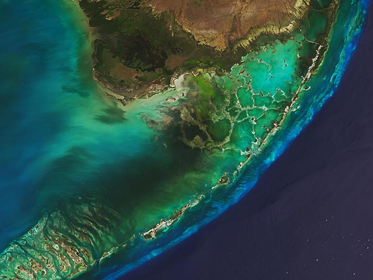
Image captured on February 27, 2024, by the MODIS instrument aboard NASA's Terra satellite.
Worldview Image of the Week
Feb. 29, 2024
The International Global Navigation Satellite Systems Service (IGS), a voluntary federation of more than 200 self-funding entities, celebrates three decades of providing high-quality data.
Feature Article
Feb. 29, 2024
SHOWING 8 OF 2371