We are in the process of migrating all NASA Earth science data sites into Earthdata from now until end of 2026. Not all NASA Earth science data and resources will appear here until then. Thank you for your patience as we make this transition.
Read about the Web Unification Project
Air Quality News
Articles, resources, and announcements from Air Quality.

The VIIRS instrument aboard the NOAA-21 platform captured this image on April 21, 2026.
Worldview Image of the Week
April 24, 2026

Several pollutants measured by TEMPO are available as ArcGIS image services, including nitrogen dioxide vertical column troposphere, formaldehyde vertical column, ozone total column, and cloud fraction.
News
April 1, 2026
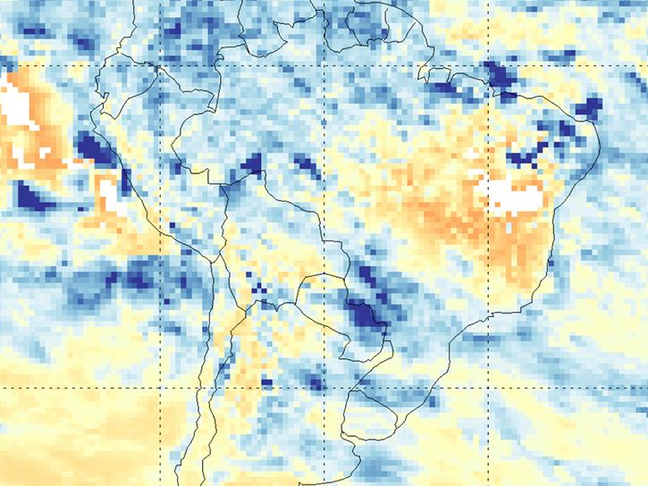
The NASA TRopospheric Ozone and Precursors from Earth System Sounding (TROPESS) project captures trace-gas emissions associated with the August 2022 Amazon fires.
Blog
March 27, 2026

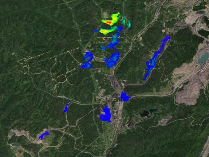
NASA has a new dataset built from ground-based sensor packages that cost less than $1,000. The data have potential for validating satellite measurements and providing local details for pollution studies.
News
March 18, 2026

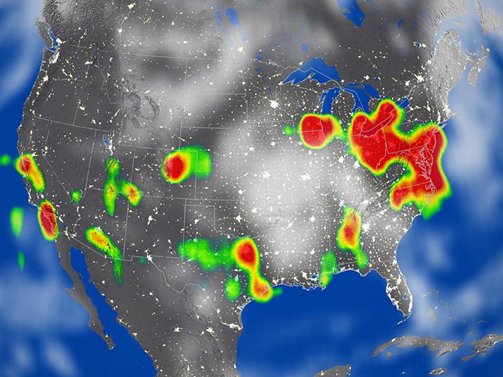
The OMPS instrument aboard the NASA/NOAA Suomi NPP platform captured imagery and data on March 5, 2026.
Worldview Image of the Week
March 6, 2026
After 25 years, the Measurements Of Pollution In The Troposphere (MOPITT) instrument ceased observing carbon monoxide (CO) in the atmosphere on Feb. 1, 2025.
News
May 6, 2025

Learn more about the NASA Commercial Satellite Data Acquisition (CSDA) program vendor GHGSat and how to discover, access, and work with their commercial methane emissions data products.
Webinar
March 3, 2025
SHOWING 8 OF 60