We are in the process of migrating all NASA Earth science data sites into Earthdata from now until end of 2026. Not all NASA Earth science data and resources will appear here until then. Thank you for your patience as we make this transition.
Read about the Web Unification Project
Precipitation Learning Resources
Webinars, tutorials, data recipes and more to help you work with Precipitation.
Filters

This ARSET training uses precipitation, soil moisture, and snow data to help reservoir managers assess inflows and manage water allocation and flood risks.
Training
Aug. 4-11, 2026

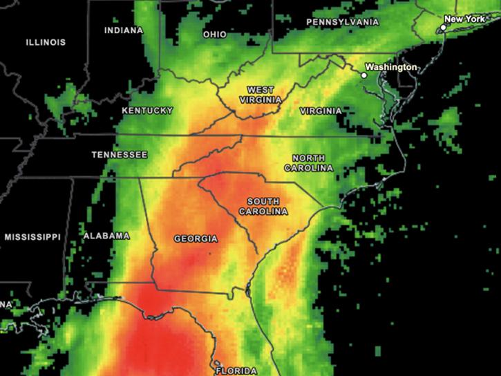
Users of NASA’s precipitation and land data assimilation products converted liquid precipitation rate to snowfall rate and snow depth using snow-to-liquid ratios.
Data in Action
Jan. 30, 2026
Visualize and download IMERG precipitation imagery using Worldview.
Tutorial
Nov. 21, 2025

This ARSET training covers NASA data providing near global coverage of coastal and near-shore satellite-derived bathymetry (SDB) measurements.
Training
Dec. 2-4, 2025
This ARSET training covers general approaches to apply satellite remote sensing data when studying or forecasting climate-sensitive infectious diseases.
Training
Oct. 7-9, 2025
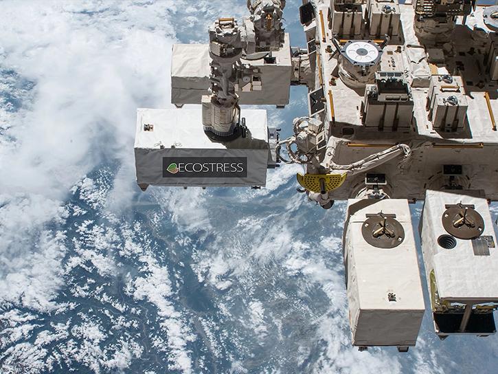
Learn how ECOSTRESS data may significantly improve wildfire prediction by capturing drought signals that precede wildland fire events.
Data in Action
Sept. 25, 2025

Learn more about NASA's Application for Extracting and Exploring Analysis Ready Samples (AppEEARS). This webinar showcases the system's capabilities and highlights learning resources to help simplify data access workflows using AppEEARS.
Webinar
April 9, 2024
Join NASA scientists and other decision-makers on Thursday, April 11, to explore the many ways NASA Earth science data are helping us to better understand and protect Earth—and how you can make a positive difference in improving life on our planet.
Webinar
March 27, 2024
SHOWING 8 OF 19
Frequently Asked Questions
Earthdata Forum
Our online forum provides a space for users to browse thousands of FAQs about research needs, data, and data applications. You can also submit new questions for our experts to answer.
Submit Questions to Earthdata Forumand View Expert Responses