We are in the process of migrating all NASA Earth science data sites into Earthdata from now until end of 2026. Not all NASA Earth science data and resources will appear here until then. Thank you for your patience as we make this transition.
Read about the Web Unification Project
Forests Learning Resources
Webinars, tutorials, data recipes and more to help you work with Forests.
Filters
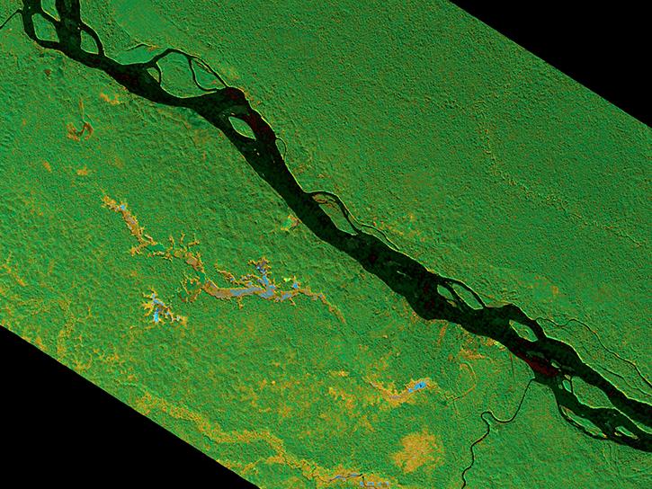
The SAR Handbook was created in 2019 as a guide for forest monitoring and biomass estimation with synthetic aperture radar (SAR).
Data Basics
April 16, 2025

External Resource
Finding

Read publication highlights that detail how ECOSTRESS data reveals water use efficiency patterns, GEDI enables precise forest carbon mapping, and moisture measurements improve wildfire prediction and management.
Data in Action
Aug. 25, 2022

Read highlights of three publications that detail how NASA Earth observation data informs forest structure mapping, disease vector tracking, and mineral identification.
Data in Action
April 26, 2021
Using simulated Global Ecosystem Dynamics Investigation (GEDI) data, a science team predicted bird occurrence probability in California.
Data in Action
March 10, 2020

See how NASA's Land Processes Distributed Active Archive Center (LP DAAC) uses land cover and vegetation continuous fields data to highlight land cover changes.
StoryMap
Jan. 16, 2020
SHOWING 8 OF 8
Frequently Asked Questions
Earthdata Forum
Our online forum provides a space for users to browse thousands of FAQs about research needs, data, and data applications. You can also submit new questions for our experts to answer.
Submit Questions to Earthdata Forumand View Expert Responses