We are in the process of migrating all NASA Earth science data sites into Earthdata from now until end of 2026. Not all NASA Earth science data and resources will appear here until then. Thank you for your patience as we make this transition.
Read about the Web Unification Project
Land Surface Learning Resources
Webinars, tutorials, data recipes and more to help you work with Land Surface.
Filters

Esta capacitación brinda una visión general del aprendizaje automático y cómo aplicar algoritmos y técnicas a datos de ciencias de la Tierra.
Training
April 20 - May 4, 2023
Join us Jan 25 at 2 p.m., ET [UTC -5], to learn how to use the Alaska Satellite Facility's OpenSARLab to work with synthetic aperture radar (SAR) data in the cloud.
Webinar
Jan. 10, 2023
Learn to access, visualize, and analyze EMIT L2A surface reflectance data using Python.
Tutorial
Dec. 5, 2022
Learn how to use the Global 30-m Height Above Nearest Drainage (HAND) dataset generated from the Copernicus GLO-30 DEM, from the image service published by NASA’s Alaska Satellite Facility Distributed Active Archive Center (ASF DAAC)
StoryMap
Dec. 2, 2022

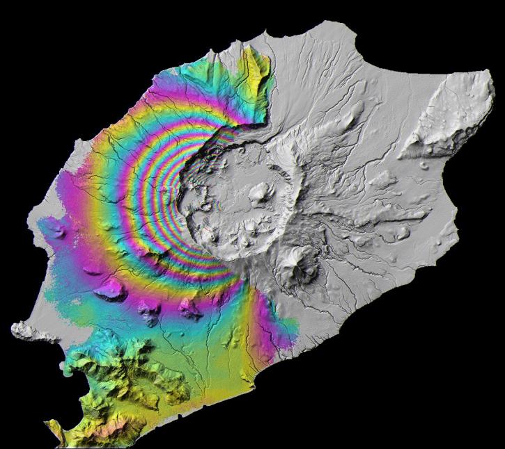
Height Above Nearest Drainage (HAND) is a terrain model that normalizes topography to the relative heights along the drainage network and is used to describe the relative soil gravitational potentials or the local drainage potentials.
Tutorial
Dec. 2, 2022

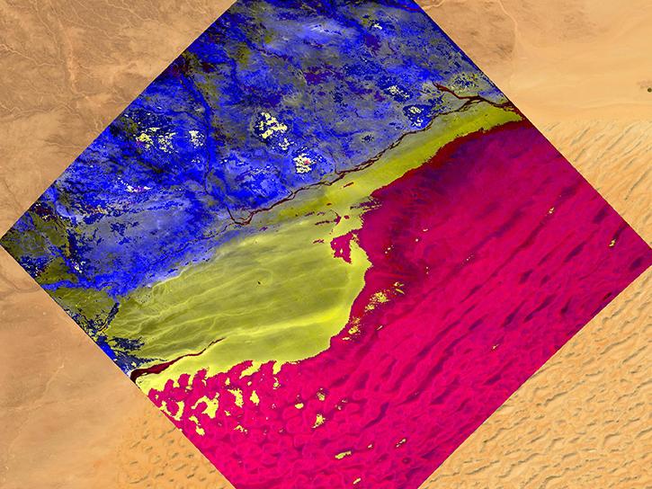
Learn about median 6-, 12-, 18-, 24-, 36- and 48-day seasonal coherence values and mean seasonal backscatter for Sentinel-1 acquisitions from December 1, 2019 through November 30, 2020.
Tutorial
Dec. 1, 2022
Access enhanced image services for NASA's ASF Global Seasonal Sentinel-1 Interferometric Coherence and Backscatter dataset.
StoryMap
Dec. 1, 2022

Esta capacitación de ARSET cubre el uso de Radar de apertura sintética (SAR) interferométrico (InSAR) SAR para evaluar riesgo de deslizamientos.
Training
Oct. 19-27, 2022
SHOWING 8 OF 203
Frequently Asked Questions
Earthdata Forum
Our online forum provides a space for users to browse thousands of FAQs about research needs, data, and data applications. You can also submit new questions for our experts to answer.
Submit Questions to Earthdata Forumand View Expert Responses