We are in the process of migrating all NASA Earth science data sites into Earthdata from now until end of 2026. Not all NASA Earth science data and resources will appear here until then. Thank you for your patience as we make this transition.
Read about the Web Unification Project
Land Surface News
Articles, resources, and announcements from Land Surface.

Learn more about the NASA Commercial Satellite Data Acquisition (CSDA) program vendor ICEYE US and how to discover, access, and work with ICEYE's high-resolution SAR products.
Webinar
April 15, 2025
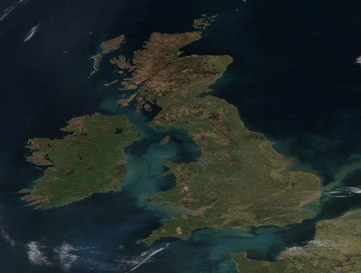
Image captured on Apr 2, 2025, by the VIIRS instrument aboard the joint NASA/NOAA Suomi NPP platform.
Worldview Image of the Week
April 4, 2025
Two new Earthdata tutorials guide users in accessing Landsat 8 data using the Application for Extracting and Exploring Analysis Ready Samples (AppEEARS) tool.
News
March 13, 2025

These new vegetation indices offer the same near-global coverage, and 30-meter spatial resolution as the initial HLS products.
News
Feb. 19, 2025
In the second ICESat-2 webinar, learn how to work with land and vegetation height data. A live demonstration will showcase the SlideRule Earth web service which provides on-demand science data processing.
Webinar
Jan. 31, 2025

The final processing of Advanced Spaceborne Thermal Emission and Reflection Radiometer (ASTER) data will make its archive more accessible to users.
Feature Article
Jan. 21, 2025

Learn more about the NASA Commercial Satellite Data Acquisition (CSDA) program vendor Capella Space and how to discover, access, and work with their SAR data products.
Webinar
Dec. 30, 2024

This is the first in a five-part webinar series to introduce NASA's Ice, Cloud, and land Elevation-2 (ICESat-2) platform and the platform's data, tools, and applications.
Webinar
Oct. 28, 2024
SHOWING 8 OF 287