Topography Data Access and Tools
NASA data detail topography across the land surface, ocean, cryosphere, terrestrial hydrosphere and within the context of climate change. Our datasets and tools help researchers translate these interconnected data points into actionable knowledge.
Topography Datasets
| Dataset Sort descending | Version | Platforms | Instruments | Temporal Extent | Spatial Extent | Spatial Resolution | Data Format |
|---|---|---|---|---|---|---|---|
| ABoVE LVIS L2 Geolocated Surface Elevation Product V001 | 1 | AIRCRAFT, B-200, C-130, DC-8, G-V, HU-25C, P-3B, RQ-4 | ALTIMETERS, LASERS, LVIS | 2017-06-29 to 2017-07-17 |
N: 72 S: 48 E: -104 W: -158 |
ASCII | |
| ABoVE: Active Layer and Soil Moisture Properties from AirMOSS P-band SAR in Alaska | 1 | G-III, Models | RADAR, Computer | 2014-08-16 to 2017-10-10 |
N: 70.8774 S: 64.7127 E: -150.249 W: -167.944 |
netCDF-4 classic | |
| ABoVE: AirSWOT Ka-band Radar over Surface Waters of Alaska and Canada, 2017 | 1 | B-200 | AirSWOT | 2017-07-08 to 2017-08-17 |
N: 70.4944 S: 46.8451 E: -98.629 W: -149.834 |
multiple | |
| ABoVE: AirSWOT Radar, Orthomosaic, and Water Masks, Yukon Flats Basin, Alaska, 2015 | 1 | B-200 | AirSWOT, CAMERA | 2015-06-15 to 2015-06-15 |
N: 66.8978 S: 65.9282 E: -145 W: -148 |
multiple | |
| ABoVE: Characterization of Burned and Unburned Boreal Forest Stands, SK, Canada, 2016 | 1 | FIELD SURVEYS, Models | STEEL MEASURING TAPE, SOIL SAMPLER, CLINOMETERS, GPS, Computer | 2016-05-30 to 2016-06-16 |
N: 57.3646 S: 54.091 E: -104.693 W: -109.173 |
CSV | |
| ABoVE: Characterization of Burned and Unburned Spruce Forest Sites, Tanana, AK, 2017 | 1 | FIELD SURVEYS, LANDSAT | PROBES, SOIL MOISTURE PROBE, TM | 2017-07-26 to 2017-07-28 |
N: 65.2315 S: 65.0968 E: -151.951 W: -152.416 |
CSV | |
| ABoVE: Dall Sheep Response to Snow and Landscape Covariates, Alaska, 2005-2008 | 1 | Models, Terra, Aqua | Computer, MODIS | 2005-09-01 to 2008-08-31 |
N: 61.0517 S: 59.976 E: -153.033 W: -154.526 |
netCDF-4 classic | |
| ABoVE: Land Cover, Methane Flux, and Environmental Data, Big Trail Lake, Fairbanks AK | 1 | Models, FIELD INVESTIGATION | Computer, SOIL MOISTURE PROBE | 2017-05-28 to 2022-08-23 |
N: 64.9231 S: 64.9201 E: -147.816 W: -147.825 |
multiple | |
| ABoVE: LVIS L3 Gridded Vegetation Structure across North America, 2017 and 2019 | 1 | G-V | LVIS | 2017-06-29 to 2019-08-08 |
N: 78.1366 S: 7.126 E: -28.8244 W: -167.324 |
multiple | |
| ABoVE: Permafrost Measurements and Distribution Across the Y-K Delta, Alaska, 2016 | 1 | IKONOS, FIELD SURVEYS, Airplane | Schmidt-Cassegrain Telescope, SOIL DEPTH PROBE, LIDAR | 2009-06-27 to 2016-07-17 |
N: 61.2881 S: 61.1694 E: -165.03 W: -165.69 |
multiple |
Learn more about ICESat-2/ATLAS near real-time data provided by NASA's Land, Atmosphere Near real-time Capability for Earth observation (LANCE).
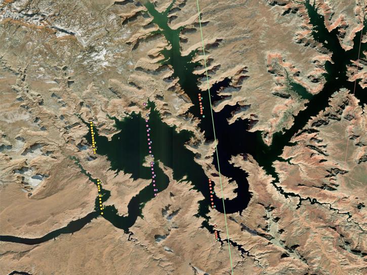
ICESat-2 carries the Advanced Topographic Laser Altimeter System (ATLAS), which sends pulses of laser light to the ground, collects the returning photons in a telescope, and records the photon travel time.
Frequently Asked Questions
Earthdata Forum
Our online forum provides a space for users to browse thousands of FAQs about research needs, data, and data applications. You can also submit new questions for our experts to answer.
Submit Questions to Earthdata Forumand View Expert Responses


