We are in the process of migrating all NASA Earth science data sites into Earthdata from now until end of 2026. Not all NASA Earth science data and resources will appear here until then. Thank you for your patience as we make this transition.
Read about the Web Unification Project
Solid Earth News
Articles, resources, and announcements from Solid Earth.
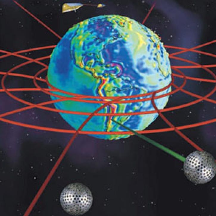
Astrophysics use Earth science satellites to explore general relativity.
Feature Article
Dec. 27, 2020

Who uses NASA Earth science data? Dr. Kristine M. Larson, to explore new ways of using remote sensing technologies.
Data User Story
Dec. 22, 2020

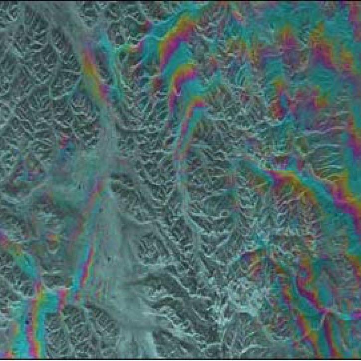
Explore and download data and imagery from EOSDIS for the the Nepalese region affected by the earthquake on April 25, 2015 and aftershocks.
Feature Article
Nov. 4, 2020

Studying modern earthquakes that produce liquefaction can help better interpret the geologic record of liquefaction during past events.
Feature Article
July 28, 2020

Craters on Earth's surface provide scientists with clues about how to identify craters on Mars.
Feature Article
July 22, 2020
Alaska's Denali Fault experienced a magnitude 7.9 earthquake in 2002.
Feature Article
July 21, 2020

This update to NASA's Crustal Dynamics Data Information System (CDDIS) archive makes accessing all RINEX data easier and more transparent for the Global Navigation Satellite System (GNSS) user community.
News
June 6, 2019

Image captured on 28 April 2019, by the MODIS instrument, aboard the Terra satellite
Worldview Image of the Week
April 29, 2019
SHOWING 8 OF 48