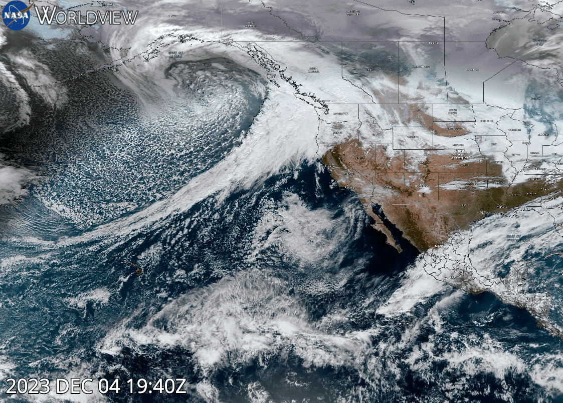
GeoColor animation acquired between 5:40 p.m., ET [22:40 UTC] on December 4, 2023, to 6:40 p.m., ET [23:40 UTC] on December 5, 2023, of an atmospheric river moving towards and over the U.S. Pacific Northwest. The imagery was captured by the Advanced Baseline Imager (ABI) instrument aboard the GOES-West (GOES-18) satellite. The powerful atmospheric river brought warm air and rainfall to the Pacific Northwest. View this animation of the atmospheric river in NASA Worldview.
The GeoColor image consists of true color imagery for day and multispectral blended infrared (IR) imagery for night. At night, the true color imagery gives way to IR-based blended multispectral imagery that provides differentiation between low liquid-water clouds (shown in light blue) and higher ice clouds (shown in gray/white). It also includes a static city lights/nighttime lights database derived from the Visible Infrared Imaging Radiometer Suite (VIIRS) Day/Night Band, which aids in geo-referencing and can help determine the proximity of clouds (such as fog) or weather hazards (such as thunderstorms or tropical cyclones) to population centers. Please note that as these lights are static, and will not change even if, for example, a weather-induced power outage occurs.
Visit Worldview to visualize near real-time imagery from NASA's EOSDIS; find more imagery in our Worldview weekly image archive.