We are in the process of migrating all NASA Earth science data sites into Earthdata from now until end of 2026. Not all NASA Earth science data and resources will appear here until then. Thank you for your patience as we make this transition.Read about the Web Unification Project
Description
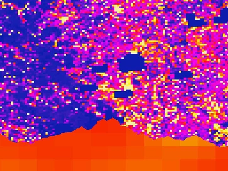
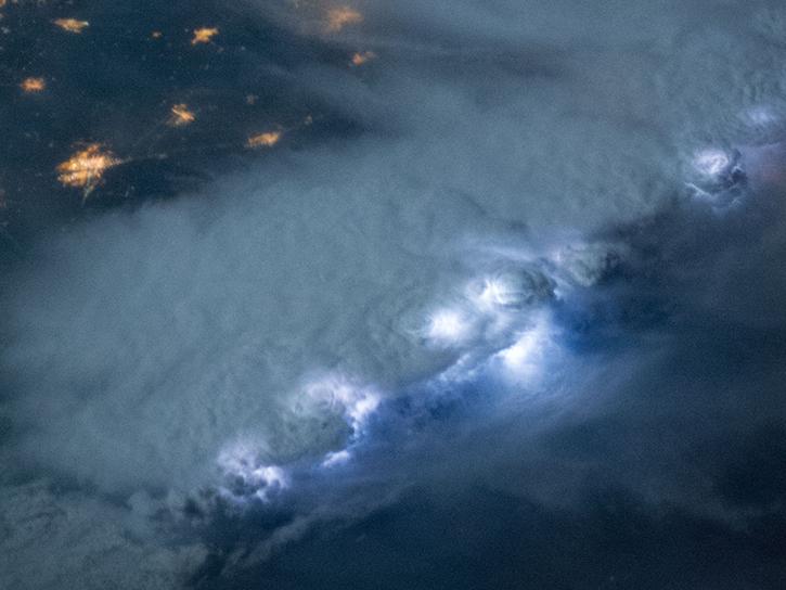
The Lightning Imaging Sensor (LIS) Science Data was collected by the LIS instrument on the Tropical Rainfall Measuring Mission (TRMM) satellite used to detect the distribution and variability of total lightning occurring in the Earth’s tropical and subtropical regions. This data can be used for severe storm detection and analysis, as well as for lightning-atmosphere interaction studies. The LIS instrument makes measurements during both day and night with high detection efficiency. These data are available in both HDF-4 and netCDF-4 formats, with corresponding browse images in GIF format.
Citation is critically important for dataset documentation and discovery. This dataset is openly shared, without restriction, in accordance with the EOSDIS Data Use and Citation Guidance.
Copy Citation
Citation Copied
Blakeslee, R. (2025). Lightning Imaging Sensor (LIS) on TRMM Science Data [Data set]. NASA Global Hydrometeorology Resource Center Distributed Active Archive Center. https://doi.org/10.5067/LIS/LIS/DATA201 Date Accessed: 2026-07-05
Blakeslee, Richard. “Lightning Imaging Sensor (LIS) on TRMM Science Data.” NASA Global Hydrometeorology Resource Center Distributed Active Archive Center, 2025. doi:10.5067/LIS/LIS/DATA201. Date Accessed: 2026-07-05
Blakeslee, Richard. Lightning Imaging Sensor (LIS) on TRMM Science Data. NASA Global Hydrometeorology Resource Center Distributed Active Archive Center, 2025, doi:10.5067/LIS/LIS/DATA201. Date Accessed: 2026-07-05