We are in the process of migrating all NASA Earth science data sites into Earthdata from now until end of 2026. Not all NASA Earth science data and resources will appear here until then. Thank you for your patience as we make this transition.
Read about the Web Unification Project
Webinars
Our online webinars, trainings, and workshops feature experts in various disciplines who share their knowledge in a particular subject area, from data in the cloud to specific data tools.
Featured Webinars

Diane Fritz, an associate scientist at NSIDC DAAC, demonstrates how to use the harmony-py Python library to customize data requests from the NASA Earthdata Cloud.
June 2, 2026,3:00-3:30 p.m. EDT(1900-1930 UTC)

User development specialist Timothy Frankstone presents a short walkthrough of content to help you discover data and other content for different Earth science topics.
May 27, 2026,2:00-2:15 p.m. EDT(1800-1815 UTC)

A data training webinar to learn about the ICESat-2 Global Geolocated Photons product and two snow depth estimation methods.
April 29, 2026,2:00-3:00 p.m. EDT(1800-1900 UTC)
Filters

Join us to learn how to use NASA's GES DISC Level 2 Subsetter to subset SO2 swath data from the NASA Ozone Monitoring Instrument (OMI)!
March 28, 2018,2:00 p.m. EDT(1800 UTC)
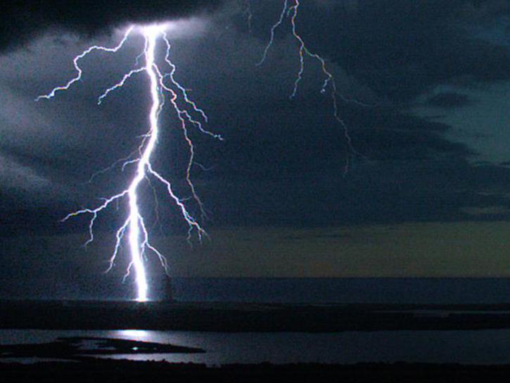
Join us to learn how the new International Space Station (ISS) Lightning Imaging Sensor (LIS) data can be used within Python, GIS and other applications to study lightning that occurred during the 2017 hurricane season.
March 7, 2018,2:00 p.m. EST(1900 UTC)

NASA GLOBE Clouds is an international citizen science program that collects cloud observations from participants around the world and compares them with satellite data. Learn more about the benefits and limitations of this citizen science data for scientific inquiry.
Feb. 28, 2018,2:00 p.m. EST(1900 UTC)

Join us to learn how to use NASA's Physical Oceanography Distributed Active Archive Center (PO.DAAC) State Of The Ocean (SOTO) toolkit to visualize and compare physical oceanography data!
Jan. 30, 2018,2:00 p.m. EST(1900 UTC)
Learn how SeaBASS can be leveraged for data search, discovery, and access, and will demonstrate how SeaBASS supports NASA’s ocean color satellite products and the broader scientific community.
Jan. 24, 2018,2:00 p.m. EST(1900 UTC)

The NASA Application for Extracting and Exploring Analysis Ready Samples (AppEEARS) brings efficiency to your scientific workflow through its ability to subset, reformat, and reproject Earth science data in one step. Tune in to learn more!
Oct. 19, 2017,2:00 p.m. EDT(1800 UTC)
During this webinar, we will provide an overview of the netCDF data format and show participants how to open, read, write and plot data that is in the netCDF format. The use case will focus on the Daymet meteorological variables data product.
Aug. 30, 2017,2:00 p.m. EDT(1800 UTC)

Join us to learn more about Global Navigation Satellite System (GNSS) radio occultation science and applications! We will highlight science impacts in the areas of numerical weather prediction, forecasting cyclone genesis, and space weather.
July 19, 2017,2:00 p.m. EDT(1800 UTC)
SHOWING 8 OF 203