We are in the process of migrating all NASA Earth science data sites into Earthdata from now until end of 2026. Not all NASA Earth science data and resources will appear here until then. Thank you for your patience as we make this transition.
Read about the Web Unification Project
Webinars
Our online webinars, trainings, and workshops feature experts in various disciplines who share their knowledge in a particular subject area, from data in the cloud to specific data tools.
Featured Webinars

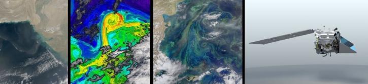
This NASA web-based tool enables near-real time monitoring of inland and coastal water quality across the U.S. and parts of Africa and South America.
July 1, 2026,2:00-3:00 p.m. EDT(1800-1900 UTC)

Learn how the Fire Information for Resource Management System (FIRMS) uses timely composite imagery to identify fire fronts, burned areas, and smoke.
July 16, 2026,2:00-3:30 p.m. EDT(1800-1930 UTC)

Diane Fritz, an associate scientist at NSIDC DAAC, demonstrates how to use the harmony-py Python library to customize data requests from the NASA Earthdata Cloud.
June 2, 2026,3:00-3:30 p.m. EDT(1900-1930 UTC)
Filters
This presentation will explore the history and evolution of satellite-borne ocean color sensors. Join us to learn about the impact of past and present sensors, and how future platforms will contribute toward a growing NASA oceanography data archive.
Feb. 26, 2020,2:00 p.m. EST(1900 UTC)

Join us to learn about NASA's Land Atmosphere Near real-time Capability for EOS (LANCE) system and available data. During this webinar we will describe the difference between NRT data and standard quality data and show you how to discover and access LANCE NRT data.
Feb. 14, 2020,2:00 p.m. EST(1900 UTC)
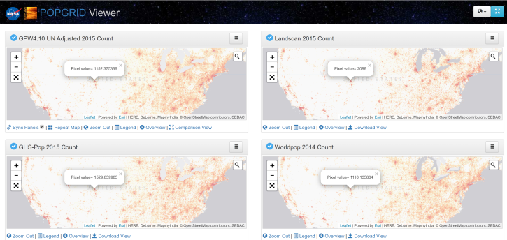
Introduction to gridded population and settlement data, an overview of gridding approaches and a demonstration on how to work with these data using SEDAC's POPGRID Viewer.
Dec. 3, 2019,2:00 p.m. EST(1900 UTC)
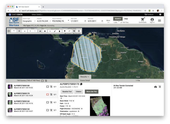
Learn how to discover, access and manipulate SAR data with the newly revamped NASA ASF DAAC Vertex tool. We'll showcase common data access methods and some of the advanced features of this data discovery and data access tool.
Nov. 20, 2019,2:00 p.m. EST(1900 UTC)

Early Adopters Workshop for the NASA Multi-Angle Imager for Aerosols (MAIA): Speciated Particulate Matter Datasets for Epidemiologists, Exposure Scientists, Air Quality Managers and Others.
Nov. 19, 2019,8:00 a.m. - 5:00 p.m. EST(1300-2200 UTC)

Learn to use the Application for Extracting and Exploring Analysis Ready Samples (AppEEARS) tool with various fire, temperature, precipitation, and vegetation data.
Oct. 25, 2019,1:00-3:00 p.m. EDT(1700-1900 UTC)

During this webinar we will introduce step-by-step methods, software, and tools that you can use to create, visualize, and standardize netCDF files before submitting your data to an archive.
Sept. 4, 2019,2:00 p.m. EDT(1800 UTC)

During this webinar we will provide answers to commonly asked questions about NASA land processes data, services and tools, and show you how to navigate the new LP DAAC website to discover data resources.
Aug. 22, 2019,2:00 p.m. EDT(1800 UTC)
SHOWING 8 OF 205