We are in the process of migrating all NASA Earth science data sites into Earthdata from now until end of 2026. Not all NASA Earth science data and resources will appear here until then. Thank you for your patience as we make this transition.
Read about the Web Unification Project
Webinars
Our online webinars, trainings, and workshops feature experts in various disciplines who share their knowledge in a particular subject area, from data in the cloud to specific data tools.
Featured Webinars

This NASA web-based tool enables near-real time monitoring of inland and coastal water quality across the U.S. and parts of Africa and South America.
July 1, 2026,2:00-3:00 p.m. EDT(1800-1900 UTC)

Learn how the Fire Information for Resource Management System (FIRMS) uses timely composite imagery to identify fire fronts, burned areas, and smoke.
July 16, 2026,2:00-3:30 p.m. EDT(1800-1930 UTC)

Diane Fritz, an associate scientist at NSIDC DAAC, demonstrates how to use the harmony-py Python library to customize data requests from the NASA Earthdata Cloud.
June 2, 2026,3:00-3:30 p.m. EDT(1900-1930 UTC)
Filters

Hosted by NASA's Goddard Earth Sciences Data and Information Services Center (GES DISC), the theme for this workshop is “Enhancing Knowledge with Giovanni”.
July 24, 2019,2:00-3:00 p.m. EDT(1800-1900 UTC)

Join us for the 4th Gregory G. Leptoukh Online Giovanni Workshop, hosted by NASA's Goddard Earth Sciences Data and Information Services Center (GES DISC). The theme for this workshop is “Enhancing Knowledge with Giovanni” and will showcase different ways Giovanni is used to enhance scientific knowledge.
July 24, 2019,2:00 p.m. EDT(1800 UTC)
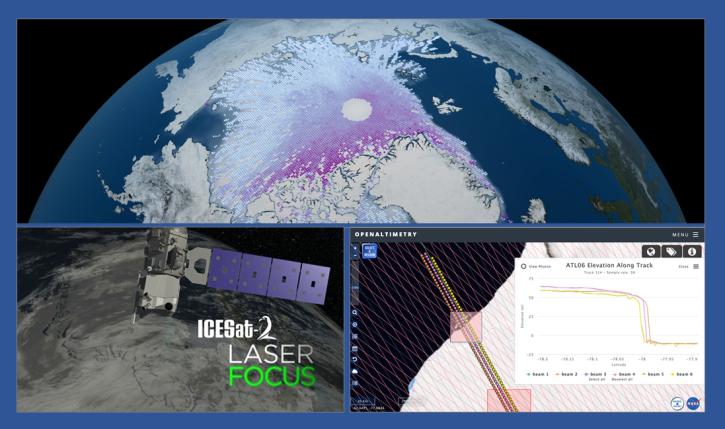
During this webinar we will introduce the ICESat-2 mission and show you how to explore, access and customize ICESat-2 data with the advanced discovery and visualization OpenAltimetry application, directly filter and access ICESat-2 data from an NSIDC DAAC data set page and subset, reformat and analyze ICESat-2 data using Python-based resources.
July 23, 2019,2:00 p.m. EDT(1800 UTC)
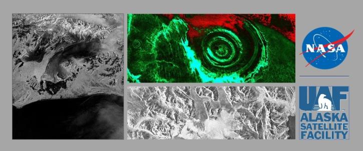
NASA's ASF DAAC has rolled out the first tool in its planned Advanced Products Toolbox for synthetic aperture radar (SAR) data with a single-command Radiometrically Terrain-Correct (RTC) tool. Join us for the tool demo and provide your input.
May 29, 2019,2:00 p.m. EDT(1800 UTC)
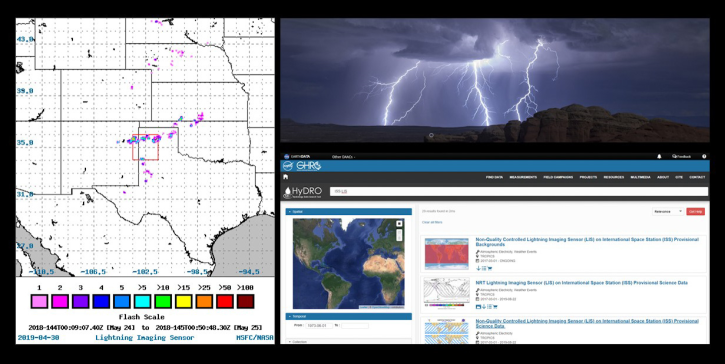
Join us to learn about the importance of lightning observations- for seasonal and long-term trends in lightning activity. We will focus on data and applications from the International Space Station's (ISS) Lightning Imaging Sensor (LIS) instrument.
May 8, 2019,2:00 p.m. EDT(1800 UTC)
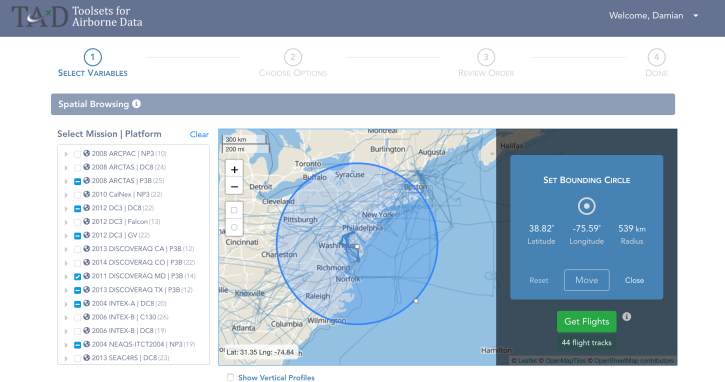
The talk will be focused around “How’s and “Why's” of full-stack Web site architecture, technology choices, and best practices. The featured use case is the Advanced Analysis of Airborne Chemistry Data web application. Target Audience: Web Engineers, Developers and Data Providers
May 3, 2019,2:00 p.m. EDT(1800 UTC)
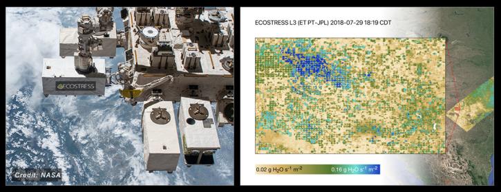
NASA's ECOSTRESS Mission studies how plants use water by measuring their temperature from space. Join us to learn more about ECOSTRESS mission measurements, data and tools!
March 28, 2019,2:00 p.m. EDT(1800 UTC)

During this webinar we will provide an overview of common geospatial operations in R including: how to import data files into R, overlay layers, reduce spatial extent, select and reclassify values, and make a map. Join us to learn more!
March 13, 2019,2:00 p.m. EDT(1800 UTC)
SHOWING 8 OF 205