We are in the process of migrating all NASA Earth science data sites into Earthdata from now until end of 2026. Not all NASA Earth science data and resources will appear here until then. Thank you for your patience as we make this transition.
Read about the Web Unification Project
Filters
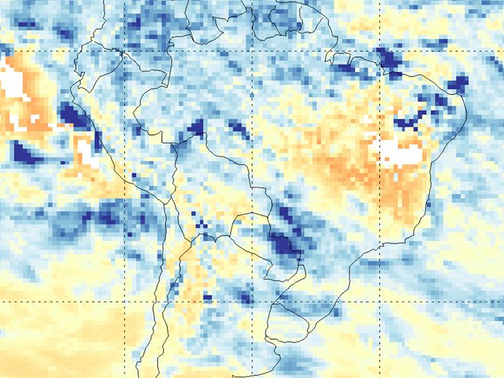
The NASA TRopospheric Ozone and Precursors from Earth System Sounding (TROPESS) project captures trace-gas emissions associated with the August 2022 Amazon fires.
Blog
March 27, 2026
Join the NASA Satellite Needs Working Group Implementation Team (NSITE) for a virtual workshop showcasing the Harmonized Landsat and Sentinel-2 (HLS) Solution.
Event
March 26, 2026

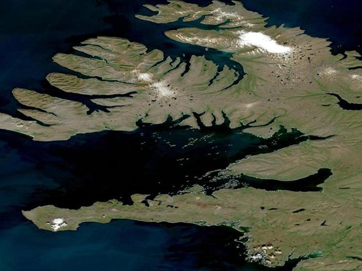
The VIIRS instrument aboard the NOAA-21 platform captured this image on March 19, 2026.
Worldview Image of the Week
March 19, 2026

NASA has a new dataset built from ground-based sensor packages that cost less than $1,000. The data have potential for validating satellite measurements and providing local details for pollution studies.
News
March 18, 2026

The VIIRS instrument aboard the NOAA-21 platform captured this image on March 10, 2026.
Worldview Image of the Week
March 13, 2026

This training offered by NASA's Applied Remote Sensing Training (ARSET) program covers applicable data sources for assessing groundwater change.
News
March 9, 2026

The OMPS instrument aboard the NASA/NOAA Suomi NPP platform captured imagery and data on March 5, 2026.
Worldview Image of the Week
March 6, 2026

The second data release since launch includes Level-1 to Level-3 L-band data products from locations around the world.
News
Feb. 27, 2026
SHOWING 8 OF 2383