We are in the process of migrating all NASA Earth science data sites into Earthdata from now until end of 2026. Not all NASA Earth science data and resources will appear here until then. Thank you for your patience as we make this transition.
Read about the Web Unification Project
Natural Hazards Learning Resources
Webinars, tutorials, data recipes and more to help you work with Natural Hazards.
Filters

Join us on Jan. 21, 2026, to explore how NISAR will revolutionize how we monitor Earth.
Webinar
Jan. 12, 2026

The Emergency Environmental Health Dashboard helped local communities assess water quality risks and infrastructure damage following Hurricane Helene and Tropical Storm Chantal.
Data in Action
Nov. 18, 2025

This ARSET training introduces participants to several capabilities within FIRMS that were not included in the previous ARSET training.
Training
Jan. 14-21, 2026
Esta capacitación de dos partes familarizará a los participantes con varias capacidades dentro de FIRMS que no se incluyeron en la capacitación de ARSET anterior.
Training
Jan. 14-21, 2026
Learn how to use AIRS soundings to determine the amount of precipitable water vapor in the atmosphere and predict whether a storm will increase in intensity.
Tutorial
Sept. 30, 2025
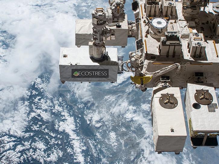
Learn how ECOSTRESS data may significantly improve wildfire prediction by capturing drought signals that precede wildland fire events.
Data in Action
Sept. 25, 2025
This ARSET training focuses on assessing projected statistics of extreme heat and cold wave events and extreme precipitation excess and deficit events.
Training
Sept. 10-17, 2025

Access resources for exploring and working with OPERA Surface Displacement from Sentinel-1 (DISP-S1) products from NASA’s Alaska Satellite Facility Distributed Active Archive Center (ASF DAAC).
StoryMap
Sept. 2, 2025
SHOWING 8 OF 158
Frequently Asked Questions
Earthdata Forum
Our online forum provides a space for users to browse thousands of FAQs about research needs, data, and data applications. You can also submit new questions for our experts to answer.
Submit Questions to Earthdata Forumand View Expert Responses