We are in the process of migrating all NASA Earth science data sites into Earthdata from now until end of 2026. Not all NASA Earth science data and resources will appear here until then. Thank you for your patience as we make this transition.
Read about the Web Unification Project
Digital Elevation/Terrain Model (DEM) Data Access and Tools
NASA's digital elevation model (DEM) data provides measurements across a majority of Earth's interior, shore, and coastal areas. Our datasets and tools help researchers translate these interconnected data points into actionable knowledge.
Digital Elevation/Terrain Model (DEM) Datasets
| Dataset Sort descending | Version | Platform | Instrument | Temporal Extent | Spatial Extent | Spatial Resolution | Data Format |
|---|---|---|---|---|---|---|---|
| GEDI L1B Geolocated Waveform Data Global Footprint Level V002 | 002 | ISS | GEDI | 2019-04-04 to 2023-03-16, 2024-04-26 to 2025-07-10 |
N: 54 S: -54 E: 180 W: -180 |
25 Meters x 25 Meters | HDF5 |
| GEDI L2B Canopy Cover and Vertical Profile Metrics Data Global Footprint Level V001 | 001 | ISS | GEDI | 2019-04-18 to 2020-09-03 |
N: 90 S: -90 E: 180 W: -180 |
25 Meters x 25 Meters | HDF5 |
| GEDI L2B Canopy Cover and Vertical Profile Metrics Data Global Footprint Level V002 | 002 | ISS | GEDI | 2019-04-04 to 2023-03-16, 2024-04-26 to 2025-07-10 |
N: 54 S: -54 E: 180 W: -180 |
25 Meters x 25 Meters | HDF5 |
| G-LiHT Metrics V001 | 001 | G-LiHT | Headwall, Riegl Airborne Lidar | 2011-06-30 to Present |
N: 73 S: 10 E: -50 W: -170 |
13 Meters x 13 Meters | GeoTIFF |
| Global 1-km Gridded Thickness of Soil, Regolith, and Sedimentary Deposit Layers | 1 | DEM | HYDROMETERS | 1900-01-01 to 2015-12-31 |
N: 90 S: -60 E: 180 W: -180 |
GeoTIFF | |
| GPM Ground Validation Airborne Snow Observatory (ASO) OLYMPEX V1 | 1 | UND CITATION II | LIDAR, VISIBLE SPECTROMETER | 2014-09-04 to 2016-03-30 |
N: 48.0909 S: 47.493 E: -123.129 W: -124.185 |
GeoTIFF | |
| High Mountain Asia 2 m DEM, Surface Velocity, and Lagrangian Surface Mass Balance for Select Debris Covered Glaciers V001 | 1 | GEOEYE-1, WORLDVIEW-1, WORLDVIEW-2, WORLDVIEW-3 | GIS, WV60, WV110 | 2012-12-23 to 2017-12-22 |
N: 28.39 S: 28.2 E: 85.77 W: 85.51 N: 28.12 S: 27.85 E: 87 W: 86.64 |
2 Meters x 2 Meters | GeoTIFF |
| High Mountain Asia 8-meter DEM Mosaics Derived from Optical Imagery V001 | 1 | GEOEYE-1, QUICKBIRD-2, WORLDVIEW-1, WORLDVIEW-2, WORLDVIEW-3 | CAMERAS, QUICKBIRD/BHRC-60 | 2002-01-28 to 2016-11-24 |
N: 46 S: 26 E: 103 W: 67 |
8 Meters x 8 Meters | PNG, GeoTIFF |
| High Mountain Asia 8-meter DEMs Derived from Along-track Optical Imagery V001 | 1 | GEOEYE-1, QUICKBIRD-2, WORLDVIEW-1, WORLDVIEW-2, WORLDVIEW-3 | CAMERAS, QUICKBIRD/BHRC-60 | 2002-01-28 to 2016-11-24 |
N: 46 S: 26 E: 103 W: 67 |
8 Meters x 8 Meters | PNG, GeoTIFF |
| High Mountain Asia 8-meter DEMs Derived from Cross-track Optical Imagery V001 | 1 | GEOEYE-1, QUICKBIRD-2, WORLDVIEW-1, WORLDVIEW-2, WORLDVIEW-3 | CAMERAS, QUICKBIRD/BHRC-60 | 2002-01-28 to 2016-11-24 |
N: 46 S: 26 E: 103 W: 67 |
8 Meters x 8 Meters | PNG, GeoTIFF |
| ISLSCP II Climate Research Unit CRU05 Monthly Climate Data | 1 | NOT APPLICABLE | NOT APPLICABLE | 1986-01-01 to 1995-12-31 |
N: 90 S: -90 E: 180 W: -180 |
multiple | |
| ISLSCP II CRU05 Climate Time Series for Global Land Areas, 1986-1995 | 1 | NOT APPLICABLE | NOT APPLICABLE | 1986-01-01 to 1995-12-31 |
N: 90 S: -90 E: 180 W: -180 |
multiple | |
| ISLSCP II HYDRO1k Elevation-derived Products | 1 | NOT APPLICABLE | NOT APPLICABLE | 1986-01-01 to 1995-12-31 |
N: 90 S: -90 E: 180 W: -180 |
Shapefile | |
| Land Cover and Vegetation Map, Arctic National Wildlife Refuge | 1 | LANDSAT, HELICOPTER, FIELD SURVEYS, DEM | TM, CAMERA, VISUAL OBSERVATIONS, Computer | 1982-06-01 to 1993-08-31 |
N: 70.7117 S: 68.8981 E: -140.322 W: -147.051 |
GeoTIFF | |
| LBA Regional Boundary for the Amazon and Tocantins River Basins, 5-min | 1 | NOT APPLICABLE | NOT APPLICABLE | 1972-01-01 to 1972-12-31 |
N: 10 S: -30 E: -30 W: -85 |
Binary | |
| LBA-ECO CD-06 Biogeochemistry of Ji-Parana River and Tributaries, Brazil: 1999-2003 | 1 | NOT APPLICABLE | NOT APPLICABLE | 1999-05-24 to 2003-05-20 |
N: -8.0333 S: -12.9269 E: -60.015 W: -63.4153 |
multiple | |
| LBA-ECO LC-15 SRTM30 Digital Elevation Model Data, Amazon Basin: 2000 | 1.1 | SPACE SHUTTLES | RADAR | 2000-02-11 to 2000-02-22 |
N: 13.8583 S: -21.1277 E: -33.5739 W: -82.7209 |
multiple | |
| LBA-ECO ND-01 Watershed Deforestation from Landsat TM Series, Rondonia, Brazil: 1999 | 1 | DEM | DIGITIZER | 1999-01-01 to 1999-12-31 |
N: -8 S: -13.5 E: -60 W: -65 |
multiple | |
| LiDAR and DTM Data from Forested Land Near Manaus, Amazonas, Brazil, 2008 | 1 | Airplane | LIDAR | 2008-06-07 to 2008-06-24 |
N: -2.32 S: -2.98306 E: -59.7625 W: -60.215 |
multiple | |
| LiDAR and DTM Data from Tapajos National Forest in Para, Brazil, 2008 | 1 | Airplane | LIDAR | 2008-06-25 to 2008-07-04 |
N: -2.84761 S: -3.055 E: -54.941 W: -54.9776 |
multiple | |
| LiDAR Data, DEM, and Maximum Vegetation Height Product from Southern Idaho, 2014 | 1 | Airplane | LIDAR | 2014-08-23 to 2014-08-31 |
N: 43.3257 S: 42.2848 E: -114.678 W: -116.889 |
multiple | |
| LiDAR Surveys over Selected Forest Research Sites, Brazilian Amazon, 2008-2018 | 1 | AIRCRAFT | LIDAR | 2008-01-01 to 2018-12-31 |
N: -1.57947 S: -26.6965 E: -39.058 W: -68.2989 |
multiple | |
| Maps of Vegetation Types and Physiographic Features, Imnavait Creek, Alaska | 1 | FIELD SURVEYS | VISUAL OBSERVATIONS | 1970-06-01 to 2015-08-31 |
N: 68.6321 S: 68.61 E: -149.258 W: -149.376 |
multiple | |
| Maps of Vegetation Types and Physiographic Features, Toolik Lake Area, Alaska | 1 | COMPUTERS | Computer | 1990-01-01 to 2014-08-31 |
N: 68.6561 S: 68.6169 E: -149.546 W: -149.67 |
Shapefile | |
| Modified Copernicus Digital Elevation Models used by the NASA-ISRO Synthetic Aperture Radar (NISAR) Mission | 1 | DEM | 2024-10-30 to Present |
N: 90 S: -90 E: 180 W: -180 |
GeoTIFF, XML |
Featured Digital Elevation/Terrain Model Observation Method: ASTER
The Advanced Spaceborne Thermal Emission and Reflection Radiometer (ASTER) is a high spatial resolution instrument aboard the Terra satellite. ASTER provides a Global Digital Elevation Models (GDEM) of Earth's land surface at approximately 30-meter spatial resolution.

Version 3 of the ASTER Global Digital Elevation Model (GDEM) provides new features and sharper imagery.

These products are available globally at their full resolution of 30 meters per pixel.
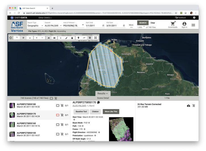
Looking for synthetic aperture radar (SAR) data? Learn how to discover, access and manipulate SAR data with the newly revamped NASA ASF DAAC Vertex tool. We'll showcase common data access methods and some of the advanced features of this data discovery and data access tool.

NASA's Commercial Satellite Data Acquisition program enables this Satellite Needs Working Group solution by providing access to two 2.0 m Digital Elevation Model (DEM) products.
Frequently Asked Questions
Earthdata Forum
Our online forum provides a space for users to browse thousands of FAQs about research needs, data, and data applications. You can also submit new questions for our experts to answer.
Submit Questions to Earthdata Forumand View Expert Responses