We are in the process of migrating all NASA Earth science data sites into Earthdata from now until end of 2026. Not all NASA Earth science data and resources will appear here until then. Thank you for your patience as we make this transition.
Read about the Web Unification Project
Land Surface News
Articles, resources, and announcements from Land Surface.

The 16 datasets in the West Africa Coastal Vulnerability Mapping collection provide a wealth of information about the stresses affecting this important region.
Feature Article
Nov. 4, 2020
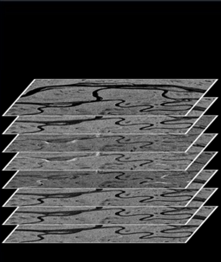
The ASF DAAC’s RTC Stacking Tool helps facilitate time-series analysis.
Feature Article
Nov. 4, 2020

Since 1999, NASA’s Terra Earth observing satellite has completed more than 100,000 orbits. The instrument data from this workhorse satellite has resulted in one of the longest continuous data records of our planet ever recorded from space.
Feature Article
Nov. 4, 2020

LANCE has started generating NRT daily 8-day rolling datasets following requests from the dust modeling and agricultural monitoring communities.
News
Nov. 4, 2020

Data from NASA’s ICESat-2 mission provide incredibly accurate measurements of Earth elevation change—and much more.
Feature Article
Nov. 4, 2020
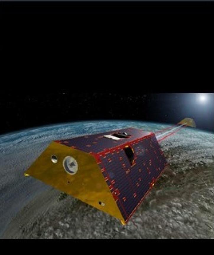
Two datasets from the Gravity Recovery and Climate Experiment Follow-On (GRACE-FO) mission have just been released by NASA’s PO.DAAC.
Feature Article
Nov. 4, 2020

Version 3 of the ASTER Global Digital Elevation Model (GDEM) provides new features and sharper imagery.
News
Nov. 4, 2020

Dr. Don McNeil at Prince of Songkla University in Thailand uses NASA Earth observing data and tools to teach his students about the natural world.
Feature Article
Nov. 4, 2020
SHOWING 8 OF 287