Floods are some of the most deadly and costly natural disasters on Earth; the National Ocean and Atmospheric Administration (NOAA) estimates that between 1980-2024, flooding cost the United States more than $200 billion, an average of $4.5 billion per flood event. Flooding frequency and severity around the world are shifting as weather and rainfall patterns change. For example, a study by the U.S. Geological Survey and Vienna University found that floods have become more frequent in the New England region since the 1940s, and that multiple areas of the U.S. are seeing an increase in the severity and duration of flood events.
NASA provides datasets for the scientific study of floods, including trends and patterns. The agency also offers tools that can aid with decisions regarding flood preparation, response, and mitigation. An important first step is being aware of conditions that can make an area more susceptible to flooding by looking at data concerning precipitation patterns, local terrain, and soil conditions.
The Soil Moisture Active-Passive (SMAP) platform, for example, uses L-band radar to measure soil moisture, as ground with high water content might be less absorbent and more susceptible to flooding. High-resolution terrain data and digital elevation models from missions like the Ice, Cloud, and land Elevation Satellite-2 (ICESat-2) and Advanced Spaceborne Thermal Emission and Reflection Radiometer (ASTER) are also crucial in modeling land drainage to understand flood risk.
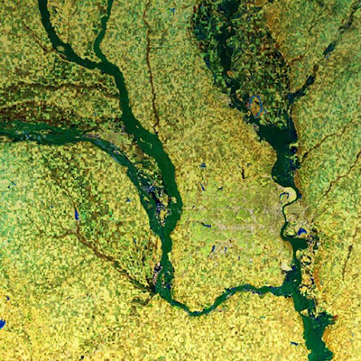
NASA measurements can later be used to map flood inundation and to understand vulnerability and exposure of communities to aid with disaster relief efforts. The Global Precipitation Mission (GPM) and Integrated Multi-satellitE Retrievals for GPM (IMERG) data product provide years of data on global rainfall patterns that support modeling and forecasting of floods. The Surface Water and Ocean Topography (SWOT) mission provides high-resolution maps of lakes, reservoirs, and rivers to inform valuable streamflow and inundation models.
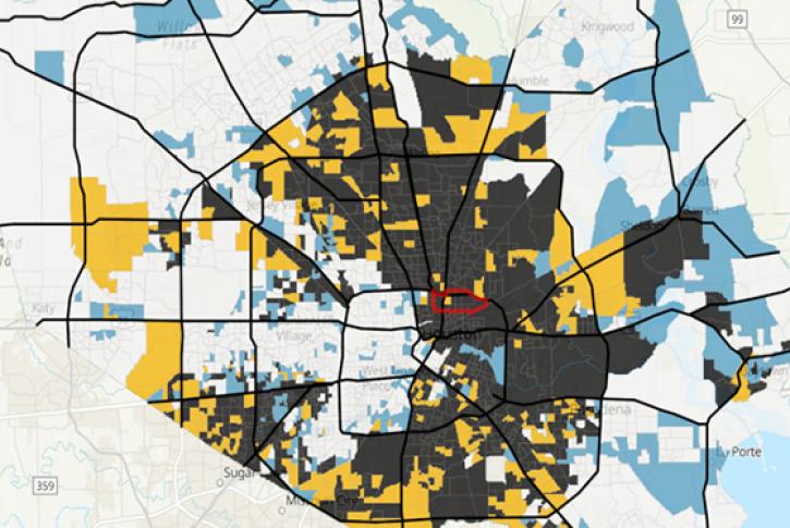
Instrument observations and model data enable managers and emergency responders to rapidly assess flooding across large areas. NASA’s instrument data include floods and surface water measurements, above-ground biomass density, land cover, leaf area indices, surface reflectance, and vegetation greenness. When combined with Earth-observing data, socioeconomic data also provide a picture of the impact of floods on cities and areas with vulnerable populations.