N: 90 S: -90 E: 180 W: -180
Description
The MOD13Q1 Version 6 data product was decommissioned on July 31, 2023. Users are encouraged to use the MOD13Q1 Version 6.1 data product.
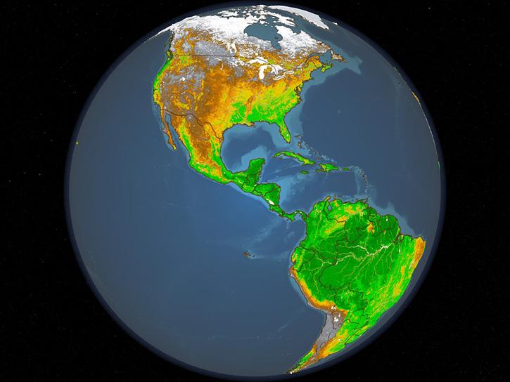
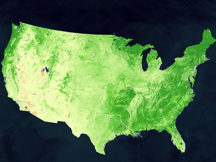
The Terra Moderate Resolution Imaging Spectroradiometer (MODIS) Vegetation Indices (MOD13Q1) Version 6 data are generated every 16 days at 250 meter (m) spatial resolution as a Level 3 product. The MOD13Q1 product provides two primary vegetation layers. The first is the Normalized Difference Vegetation Index (NDVI) which is referred to as the continuity index to the existing National Oceanic and Atmospheric Administration-Advanced Very High Resolution Radiometer (NOAA-AVHRR) derived NDVI. The second vegetation layer is the Enhanced Vegetation Index (EVI), which has improved sensitivity over high biomass regions. The algorithm chooses the best available pixel value from all the acquisitions from the 16 day period. The criteria used is low clouds, low view angle, and the highest NDVI/EVI value.
Along with the vegetation layers and the two quality layers, the HDF file will have MODIS reflectance bands 1 (red), 2 (near-infrared), 3 (blue), and 7 (mid-infrared), as well as four observation layers.
Known Issues
-
The following issues have been detected:
- Unexpected missing data in the last cycles of each year.
- Incorrect instances of "NoData" and spikes in NDVI values.
- VI Usefulness Bits are not correctly assigned.
- For instances where the VI Quality (bits 0-1) is flagged as good and the VI Usefulness (bits 2-5) indicates the same pixels have the lowest usefulness score, users are advised to disregard the usefulness score.
- The incorrect representation of the aerosol quantities (low, average, high) in the Collection 6 MOD09 surface reflectance products may have impacted MOD13 Vegetation Index data products particularly over arid bright surfaces.
- Corrections were implemented in Collection 6.1 reprocessing.
- For complete information about known issues please refer to the MODIS/VIIRS Land Quality Assessment website.
Version Description
Product Summary
Citation
Citation is critically important for dataset documentation and discovery. This dataset is openly shared, without restriction, in accordance with the EOSDIS Data Use and Citation Guidance.
Copy Citation
File Naming Convention
The file name begins with the Product Short Name (MOD13Q1) followed by the Julian Date of Acquisition formatted as AYYYYDDD (A2002257), the Tile Identifier which is horizontal tile and vertical tile provided as hXXvYY (h08v08), the Version of the data collection (006), the Julian Date and Time of Production designated as YYYYDDDHHMMSS (2015151081151), and the Data Format (hdf).
Documents
USER'S GUIDE
ALGORITHM THEORETICAL BASIS DOCUMENT (ATBD)
PRODUCT QUALITY ASSESSMENT
Dataset Resources
Publications Citing This Dataset
Variables
Variables are a set of physical properties whose values determine the characteristics or behavior of something. For example, temperature and pressure are variables of the atmosphere. Parameters and variables can be used interchangeably. Variable level attributes provide individual information for each variable.
The Name in this table is the variable name. Fill value indicates missing or undefined data points in a variable. Valid range is the range of values the variable can store. Scale factor is used to increase or decrease the size of an object and can be used to correct for distortion. For questions on a specific variable, please use the Earthdata Forum.
| Name Sort descending | Description | Units | Data Type | Fill Value | Valid Range | Scale Factor |
|---|---|---|---|---|---|---|
| 250m 16 days blue reflectance | Surface Reflectance Band 3 | N/A | int16 | -1000 | 0 to 10000 | 0.0001 |
| 250m 16 days composite day of the year | Day of year VI pixel | Julian day | int16 | -1 | 1 to 366 | N/A |
| 250m 16 days EVI | 16 day EVI | EVI | int16 | -3000 | -2000 to 10000 | 0.0001 |
| 250m 16 days MIR reflectance | Surface Reflectance Band 7 | N/A | int16 | -1000 | 0 to 10000 | 0.0001 |
| 250m 16 days NDVI | 16 day NDVI | NDVI | int16 | -3000 | -2000 to 10000 | 0.0001 |
| 250m 16 days NIR reflectance | Surface Reflectance Band 2 | N/A | int16 | -1000 | 0 to 10000 | 0.0001 |
| 250m 16 days pixel reliability | Quality reliability of VI pixel | Rank | int8 | -1 | 0 to 3 | N/A |
| 250m 16 days red reflectance | Surface Reflectance Band 1 | N/A | int16 | -1000 | 0 to 10000 | 0.0001 |
| 250m 16 days relative azimuth angle | Relative azimuth angle of VI pixel | Degree | int16 | -4000 | -18000 to 18000 | 0.01 |
| 250m 16 days sun zenith angle | Sun zenith angle of VI pixel | Degree | int16 | -10000 | 0 to 18000 | 0.01 |
| 250m 16 days view zenith angle | View zenith angle of VI Pixel | Degree | int16 | -10000 | 0 to 18000 | 0.01 |
| 250m 16 days VI Quality | VI quality indicators | Bit Field | uint16 | 65535 | 0 to 65534 | N/A |


