We are in the process of migrating all NASA Earth science data sites into Earthdata from now until end of 2026. Not all NASA Earth science data and resources will appear here until then. Thank you for your patience as we make this transition.
Read about the Web Unification Project
SMAP Resources
Earthdata offers a range of resources for users working with Soil Moisture Active Passive (SMAP) data. These include tutorials and other learning opportunities as well as related news, documents, and frequently asked questions.
Documents
| Name Sort descending | Description | File Type | Date Published | |
|---|---|---|---|---|
| NASA/RSS SMAP Salinity: Version 5.0 Validated Release | NASA/RSS SMAP Salinity: Version 5.0 Validated Release | PDF (6.13 mb) | June 21, 2023 | |
| NASA/RSS SMAP Salinity: Version 6.0 Validated Release | NASA/RSS SMAP Salinity: Version 6.0 Validated Release - Release Notes | PDF (4.34 mb) | Jan. 18, 2024 | |
| SMAP Salinity and Wind Speed Data User Guide | SMAP Salinity and Wind Speed Data User Guide | PDF (5.94 mb) | Nov. 12, 2020 |
SHOWING 3 OF 3
SMAP Learning Resources

The Emergency Environmental Health Dashboard helped local communities assess water quality risks and infrastructure damage following Hurricane Helene and Tropical Storm Chantal.
Data in Action
Nov. 18, 2025
This ARSET training teaches participants how satellite-based Earth observations can inform landslide science and disaster planning.
Training
March 11-18, 2025

Can summer salinity values help better predict ice formation in the fall?
StoryMap
Jan. 22, 2025

Join us to learn more about datasets and tools that enable the harmonization of remote sensing and in situ ecological data products for site-based research.
Webinar
Aug. 22, 2024

Research shows that coastal sea surface temperatures could be used as a proxy for detecting changes that are expected in the cycling of water between the oceans and continents.
Data in Action
April 18, 2024

Learn more about NASA's Application for Extracting and Exploring Analysis Ready Samples (AppEEARS). This webinar showcases the system's capabilities and highlights learning resources to help simplify data access workflows using AppEEARS.
Webinar
April 9, 2024

The SASSIE project aimed to determine if sea surface salinity variations generated by summer sea ice melt are an important predictor for sea ice advance in the fall.
Data in Action
Jan. 30, 2024

This advanced-level training focuses on using remote sensing observations for monitoring post-fire impacts on watershed health.
Training
July 6-13, 2023
SHOWING 8 OF 35
SMAP News
View All News
Filters
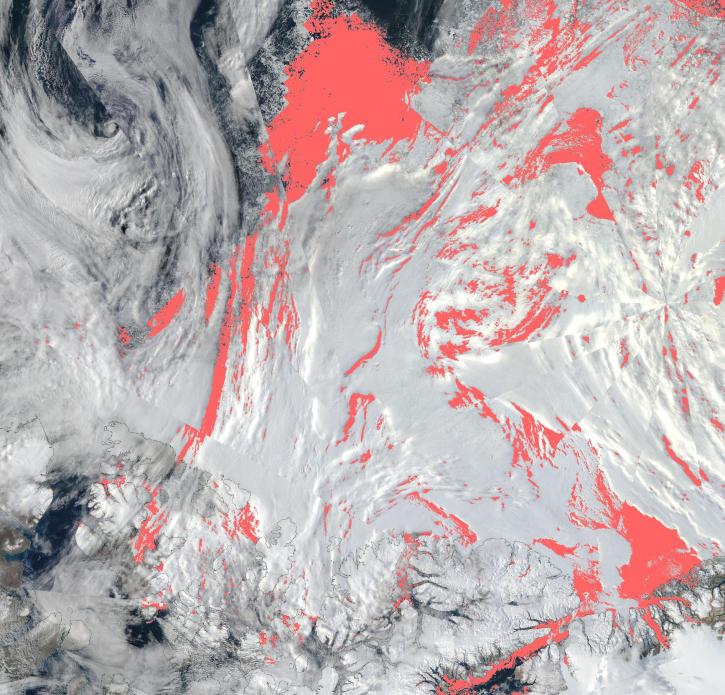
View a list of the layers that now show previously hidden pixel classifications.
Blog
Sept. 12, 2023

A summary of datasets, products, and resources released by NASA’s Distributed Active Archive Centers (DAACs) in August 2023.
News
Sept. 5, 2023

Terrestrial Ecology Subsetting and Visualization Services (TESViS) supports ecological field research in easy-to-use formats.
Feature Article
June 30, 2023

Data from NASA’s NSIDC DAAC help scientists like Dr. Fadji Z. Maina research hydrological change in High Mountain Asia.
Data User Story
April 27, 2023
AppEEARS allows users to subset data spatially, temporally, and by layer, reducing the amount of data they need to download.
Feature Article
April 3, 2023

Updated sea surface salinity data products fill an Earth observing need identified in the 2020 Satellite Needs Working Group (SNWG) survey of federal agencies.
News
March 7, 2023

Data from NASA’s ORNL DAAC help Dr. Kyla Dahlin better understand how remote sensing can improve predictive ecological models.
Data User Story
Feb. 28, 2023
The app enables users to overlay multiple data layers, including precipitation, storm track, and sea surface temperature.
News
Aug. 24, 2022
SHOWING 8 OF 43
Frequently Asked Questions
Earthdata Forum
Our online forum provides a space for users to browse thousands of FAQs about research needs, data, and data applications. You can also submit new questions for our experts to answer.
Submit Questions to Earthdata Forumand View Expert Responses