We are in the process of migrating all NASA Earth science data sites into Earthdata from now until end of 2026. Not all NASA Earth science data and resources will appear here until then. Thank you for your patience as we make this transition.
Read about the Web Unification Project
SMAP Resources
Earthdata offers a range of resources for users working with Soil Moisture Active Passive (SMAP) data. These include tutorials and other learning opportunities as well as related news, documents, and frequently asked questions.
Documents
| Name Sort descending | Description | File Type | Date Published | |
|---|---|---|---|---|
| NASA/RSS SMAP Salinity: Version 5.0 Validated Release | NASA/RSS SMAP Salinity: Version 5.0 Validated Release | PDF (6.13 mb) | June 21, 2023 | |
| NASA/RSS SMAP Salinity: Version 6.0 Validated Release | NASA/RSS SMAP Salinity: Version 6.0 Validated Release - Release Notes | PDF (4.34 mb) | Jan. 18, 2024 | |
| SMAP Salinity and Wind Speed Data User Guide | SMAP Salinity and Wind Speed Data User Guide | PDF (5.94 mb) | Nov. 12, 2020 |
SHOWING 3 OF 3
SMAP Learning Resources

Researchers use NASA data to better understand key mechanisms responsible for near-surface salinity variations in the ocean.
Data in Action
Oct. 3, 2019

This ARSET training focuses on Earth observation data useful for disaster risk assessment.
Training
Aug. 6-15, 2019

NASA data helps researchers track post-storm changes in sea surface temperature and ocean salinity.
Data in Action
June 12, 2019

Esta capacitación de ARSET cubre cómo usar datos de la NASA para caracterizar eventos de desastres y apoyar esfuerzos de ayuda.
Training
April 16-30, 2019
This ARSET training shows how NASA remote sensing data can be used to characterize and monitor disaster-related events and support relief efforts.
Training
April 16-30, 2019

This ARSET training introduces using satellite data and Earth system modeling data sources to estimate surface water budgets.
Training
March 13 - April 3, 2019

Remote sensing data's drought-indicating parameters are essential to manage the impact of water scarcities and minimize drought losses.
Data in Action
June 27, 2018

This ARSET training provides an overview of drought classification and web-based tools for drought monitoring and visualization.
Training
July 12-19, 2017
SHOWING 8 OF 36
SMAP News
View All News
Filters
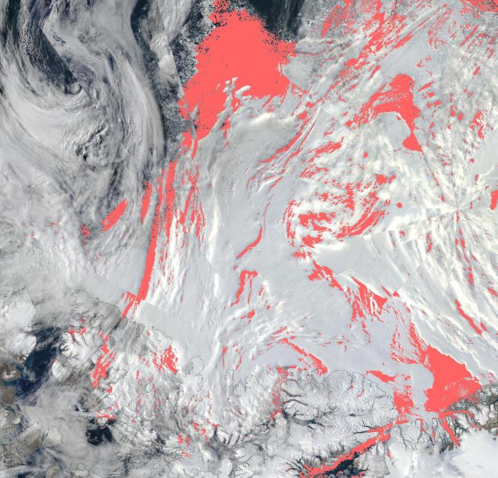
View a list of the layers that now show previously hidden pixel classifications.
Blog
Sept. 12, 2023

A summary of datasets, products, and resources released by NASA’s Distributed Active Archive Centers (DAACs) in August 2023.
News
Sept. 5, 2023

Terrestrial Ecology Subsetting and Visualization Services (TESViS) supports ecological field research in easy-to-use formats.
Feature Article
June 30, 2023

Data from NASA’s NSIDC DAAC help scientists like Dr. Fadji Z. Maina research hydrological change in High Mountain Asia.
Data User Story
April 27, 2023
AppEEARS allows users to subset data spatially, temporally, and by layer, reducing the amount of data they need to download.
Feature Article
April 3, 2023

Updated sea surface salinity data products fill an Earth observing need identified in the 2020 Satellite Needs Working Group (SNWG) survey of federal agencies.
News
March 7, 2023

Data from NASA’s ORNL DAAC help Dr. Kyla Dahlin better understand how remote sensing can improve predictive ecological models.
Data User Story
Feb. 28, 2023
The app enables users to overlay multiple data layers, including precipitation, storm track, and sea surface temperature.
News
Aug. 24, 2022
SHOWING 8 OF 43
Frequently Asked Questions
Earthdata Forum
Our online forum provides a space for users to browse thousands of FAQs about research needs, data, and data applications. You can also submit new questions for our experts to answer.
Submit Questions to Earthdata Forumand View Expert Responses