We are in the process of migrating all NASA Earth science data sites into Earthdata from now until end of 2026. Not all NASA Earth science data and resources will appear here until then. Thank you for your patience as we make this transition.
Read about the Web Unification Project
Filters

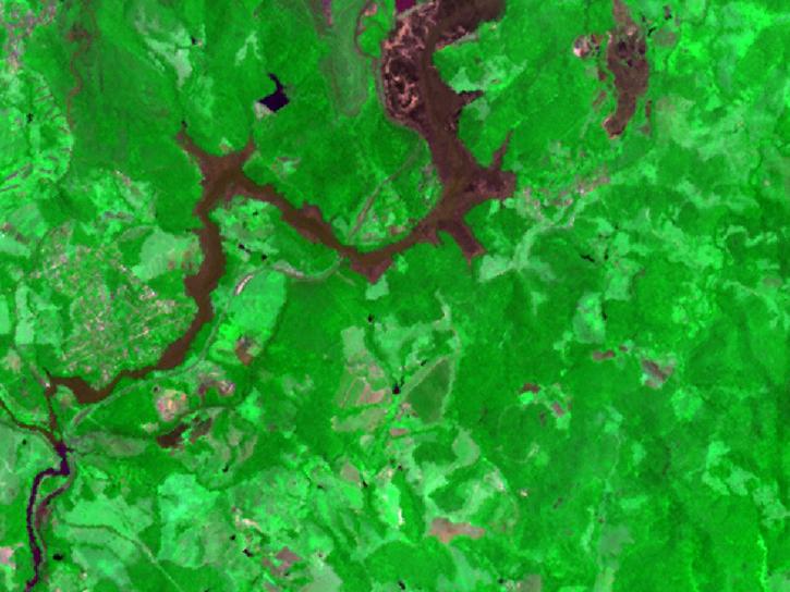
Explore how satellite data supported soybean crop modeling in Brazil and the U.S., hurricane and drought damage assessment in the Caribbean, and dam site evaluation in northern Iraq.
Data in Action
Oct. 28, 2019

We're providing a rolling month of geostationary imagery from GOES-East, GOES-West, and Himawari-8.
Blog
Oct. 21, 2019

Researchers use NASA data to better understand key mechanisms responsible for near-surface salinity variations in the ocean.
Data in Action
Oct. 3, 2019

This tutorial demonstrates how to ingest FIRMS KML fire data into Google Earth Pro with automatic refresh.
Tutorial
Aug. 23, 2019

Europe experienced a heat wave in 2019, highlighting the dangers of urban heat islands and the potential of ECOsystem Spaceborne Thermal Radiometer (ECOSTRESS) data to identify at-risk areas.
Data in Action
Aug. 21, 2019

The Microwave Limb Sounder Near-Real Time (MLS NRT) products are provided by the Land, Atmosphere Near-real time Capability for EOS (LANCE).
News
Aug. 15, 2019
Version 3 of the ASTER GDEM product is available free of charge worldwide.
News
Aug. 5, 2019
Read publication highlights that detail how NASA data are used to monitor climate-driven vegetation changes, wind-driven sediment plumes in lakes, and volcanic eruption processes.
Data in Action
July 31, 2019
SHOWING 8 OF 2378