We are in the process of migrating all NASA Earth science data sites into Earthdata from now until end of 2026. Not all NASA Earth science data and resources will appear here until then. Thank you for your patience as we make this transition.
Read about the Web Unification Project
Data in Action
All across the planet, NASA Earth science data are used to meet real-world challenges.
Featured Data in Action

5 MIN READ
The eBird project uses NASA data and observations from amateur birdwatchers to provide insights into the decline in avian populations throughout North America.
June 17, 2025

5 MIN READ
A comparison of aurora forecasts with actual satellite observations suggests VIIRS DNB data can enhance space weather prediction efforts.
May 30, 2025
Filters

1 MIN READ
A new algorithm was developed to infer particle size distribution parameters from the SAGE III instrument extinction spectra using a lookup table (LUT) approach.
Feb. 1, 2024

3 MIN READ
The SASSIE project aimed to determine if sea surface salinity variations generated by summer sea ice melt are an important predictor for sea ice advance in the fall.
Jan. 30, 2024

2 MIN READ
SWOT data reveals the topography of the ocean surface at finer scales than ever before.
Dec. 7, 2023
3 MIN READ
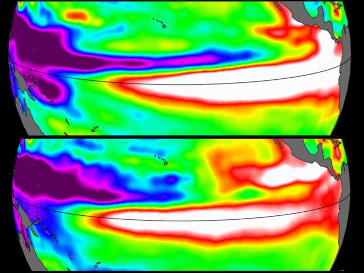
Sea surface height data from the Sentinel-6 Michael Freilich mission reveal complex interactions between the ocean and the atmosphere that affect global weather and climate such as El Niño.
Oct. 31, 2023

2 MIN READ
SWOT provides high-resolution data to help researchers monitor the vertical transport of heat and carbon within the ocean.
Sept. 15, 2023
4 MIN READ
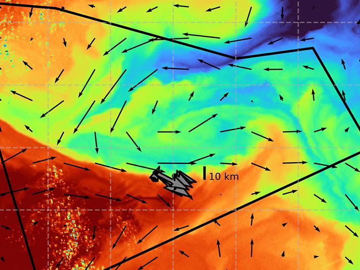
The S-MODE project combined airborne remote sensing and in-situ data to reveal upper-ocean dynamics and small-scale ocean features.
Aug. 29, 2023

3 MIN READ
Satellite data provides indicators of El Niño events.
June 15, 2023

7 MIN READ
The eBird tool leverages NASA's remote sensing data to monitor bird populations and habitats and aid in conservation efforts.
May 8, 2023
SHOWING 8 OF 186