We are in the process of migrating all NASA Earth science data sites into Earthdata from now until end of 2026. Not all NASA Earth science data and resources will appear here until then. Thank you for your patience as we make this transition.
Read about the Web Unification Project
Filters

This image was captured on July 30, 2025, by the VIIRS instrument aboard the joint NASA/NOAA NOAA-21 platform.
Worldview Image of the Week
July 31, 2025

Near real-time products available through LANCE provide crucial details about aerosol properties and atmospheric composition.
Blog
July 31, 2025

The latest installment of the DPDG offers data product developers a consolidated, comprehensive guide for creating data products that best serve NASA’s end-user community.
Blog
July 30, 2025
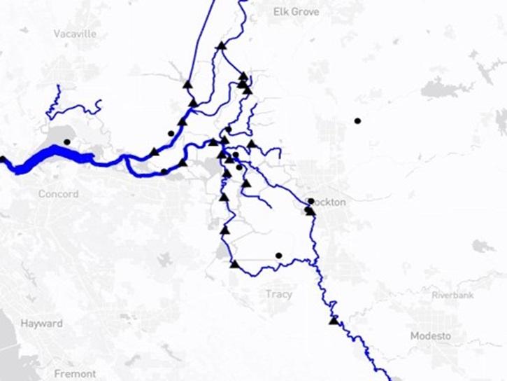
The Water Information from SPace (WISP) dashboard brings together data from NASA’s SWOT satellite and USGS streamgages in a user-friendly application.
Blog
July 30, 2025

The fourth NASA ICESat-2 data training webinar features ICESat-2 sea ice datasets, services, and tools.
Webinar
July 25, 2025

This image was captured on July 23, 2025, by the VIIRS instrument aboard the joint NASA/NOAA Suomi NPP platform.
Worldview Image of the Week
July 24, 2025

Learn about advanced filtering methods that exist to help you find the data you need in Earthdata Search.
Tutorial
July 24, 2025

Learn how to use Earthdata Search features for efficiently filtering data by space and time.
News
July 24, 2025
SHOWING 8 OF 2386