We are in the process of migrating all NASA Earth science data sites into Earthdata from now until end of 2026. Not all NASA Earth science data and resources will appear here until then. Thank you for your patience as we make this transition.
Read about the Web Unification Project
Ocean Waves Data Access and Tools
Ocean waves data from NASA range from regularly updated high-resolution Sentinel-1 radar imagery to historical Seasat data. Our datasets and tools help users find and integrate the data they need to learn more about the nature of ocean waves and their contributions to sea and coastal processes.
Ocean Waves Datasets
| Dataset Sort descending | Version | Platform | Instrument | Temporal Extent | Spatial Extent | Spatial Resolution | Data Format |
|---|---|---|---|---|---|---|---|
| AIRSAR_ALONGTRACK_INTERFEROMETRY_JPG | 1 | DC-8 | AIRSAR | 1998-10-25 to 2004-03-05 | |||
| ALOS PALSAR High Resolution Radiometric Terrain Corrected Product | 1 | ALOS | PALSAR | 2006-03-23 to 2011-04-22 |
N: 90 S: -90 E: 180 W: -180 |
||
| ALOS PALSAR Level 1.0 Product | 1 | ALOS | PALSAR | 2006-03-23 to 2011-04-22 |
N: 90 S: -90 E: 180 W: -180 |
||
| ALOS PALSAR Level 1.1 Product | 1 | ALOS | PALSAR | 2006-01-23 to 2011-05-23 |
N: 90 S: -90 E: 180 W: -180 |
||
| ALOS PALSAR Level 1.5 Product | 1 | ALOS | PALSAR | 2006-03-23 to 2011-04-22 |
N: 90 S: -90 E: 180 W: -180 |
||
| ALOS PALSAR Level 2.2 Product | 1 | ALOS | PALSAR | 2006-01-23 to 2011-05-23 |
N: 90 S: -90 E: 180 W: -180 |
||
| ALOS PALSAR Low Resolution Radiometric Terrain Corrected Product | 1 | ALOS | PALSAR | 2006-03-23 to 2011-04-22 |
N: 90 S: -90 E: 180 W: -180 |
||
| First ISCCP Regional Experiment (FIRE) Atlantic Stratocumulus Transition Experiment (ASTEX) ERS-1 Altimeter Data | 1 | ERS-1 | RADAR ALTIMETERS | 1992-06-01 to 1992-06-15 | ASCII | ||
| First ISCCP Regional Experiment (FIRE) Atlantic Stratocumulus Transition Experiment (ASTEX) SOFIA Le Suroit Hydrophone Data | 1 | BUOYS | HYDROPHONES | 1992-06-02 to 1992-06-19 | ASCII | ||
| First ISCCP Regional Experiment (FIRE) Atlantic Stratocumulus Transition Experiment (ASTEX) SOFIA Spear Buoy Data | 1 | BUOYS | ACCELEROMETERS | 1992-06-01 to 1992-06-30 | ASCII | ||
| GEOS-3 ALTIMETER GEOPHYSICAL DATA RECORD 1975-1978 | 1 | GEOS-3 | GEOS-3 ALTIMETER | 1975-04-14 to 1978-12-02 |
N: 90 S: -90 E: 180 W: -180 |
RAW | |
| Jason-1 GDR SSHA version E NetCDF | E | JASON-1 | JASON-1 Microwave Radiometer, POSEIDON-2 | 2002-01-14 to 2012-03-03 |
N: 66.15 S: -66.15 E: 180 W: -180 |
netCDF-4 | |
| Jason-1 GDR SSHA version E NetCDF Geodetic | E | Jason-1 Geodetic | JASON-1 Microwave Radiometer, POSEIDON-2 | 2012-05-07 to 2013-06-21 |
N: 66.15 S: -66.15 E: 180 W: -180 |
netCDF-4 | |
| Jason-1 GDR version E NetCDF | E | JASON-1 | DORIS, JASON-1 Microwave Radiometer, POSEIDON-2 | 2002-01-14 to 2012-03-03 |
N: 66.15 S: -66.15 E: 180 W: -180 |
netCDF-4 | |
| Jason-1 GDR version E NetCDF Geodetic | E | Jason-1 Geodetic | DORIS, JASON-1 Microwave Radiometer, POSEIDON-2 | 2012-05-07 to 2013-06-21 |
N: 66.15 S: -66.15 E: 180 W: -180 |
netCDF-4 | |
| Jason-1 SGDR version E NetCDF | E | JASON-1 | TRSR, DORIS, JASON-1 Microwave Radiometer, POSEIDON-2 | 2002-01-14 to 2012-03-03 |
N: 66.15 S: -66.15 E: 180 W: -180 |
netCDF-4 | |
| Jason-1 SGDR version E NetCDF Geodetic | E | Jason-1 Geodetic | TRSR, DORIS, JASON-1 Microwave Radiometer, POSEIDON-2 | 2012-05-07 to 2013-06-21 |
N: 66.15 S: -66.15 E: 180 W: -180 |
netCDF-4 | |
| Jason-3 GPS based orbit and SSHA OGDR | G | JASON-3 | AMR, GPSP, POSEIDON-3 | 2020-10-29 |
N: 66 S: -66 E: 180 W: -180 |
netCDF-4 | |
| Jason-3 Wet Path Delay Correction | F | JASON-3 | AMR, GPSP, POSEIDON-3 | 2016-02-12 |
N: 66 S: -66 E: 180 W: -180 |
ascii | |
| KMZ for ALOS PALSAR Radiometric Terrain Corrected Product | 1 | ALOS | PALSAR | 2006-03-23 to 2011-04-22 |
N: 90 S: -90 E: 180 W: -180 |
||
| LBA-ECO CD-03 Nocturnal Meteorological Data, Forest and Pasture Sites, Para, Brazil | 1 | BALLOONS | IRGA, WIND MONITOR, PRESSURE SENSORS, THERMISTORS, HUMIDITY SENSORS | 2001-07-26 to 2003-11-26 |
N: -3.017 S: -3.0202 E: -54.8885 W: -54.9707 |
CSV | |
| RADARSAT-1 Level 0 Product | 1 | RADARSAT-1 | SAR | 1996-02-01 to 2009-03-17 |
N: 90 S: -90 E: 180 W: -180 |
||
| RADARSAT-1 Level 1 Product | 1 | RADARSAT-1 | SAR | 1996-02-01 to 2009-03-17 |
N: 90 S: -90 E: 180 W: -180 |
||
| Saildrone 2021 Arctic field campaign for the Multi-Sensor Improved SST (MISST) project | 1 | Saildrone | CTD, ADCP, ANEMOMETERS, FLUOROMETERS, TEMPERATURE SENSORS, HUMIDITY SENSORS, PYROMETERS, PAR SENSORS, BAROMETERS | 2021-07-06 to 2021-10-21 |
N: 71 S: 65 E: -164.5 W: -168 |
netCDF-4 | |
| Saildrone 2022 Arctic field campaign for the Multi-Sensor Improved SST (MISST) project | 1 | Saildrone | CTD, ADCP, ANEMOMETERS, FLUOROMETERS, TEMPERATURE SENSORS, HUMIDITY SENSORS, PYROMETERS, PAR SENSORS, BAROMETERS | 2022-06-18 to 2022-08-17 |
N: 71.6 S: 65.2 E: -157.2 W: -168.5 |
netCDF-4 |
Featured Ocean Waves Observation Method: GNSS
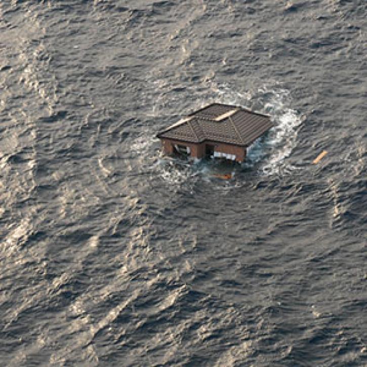
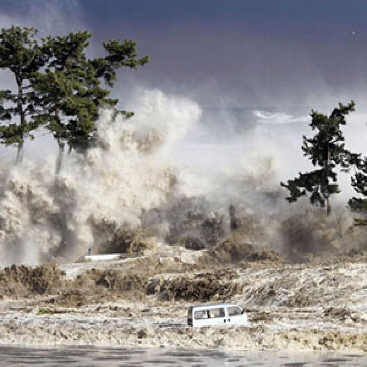
Data from a Global Navigation Satellite System (GNSS), such as global positioning system (GPS) measurements, can be used to estimate the strength and direction of tsunamis following an earthquake by calculating how much land moved near water and the energy transmitted into the ocean.
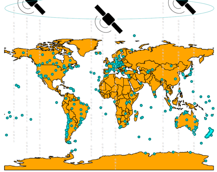
Join us on Sept. 28 to learn about the NASA Making Earth System Data Records (ESDR) for Use in Research Environments (MEaSUREs) Extended Solid Earth Science ESDR System (ESESES) project, whose Global Navigation Satellite System (GNSS)-derived data products enable research on tectonic motion, crustal deformation, earthquakes, tsunamis, sea level rise, extreme weather, and more!
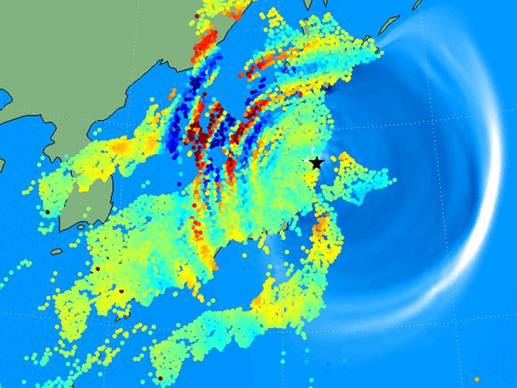
Learn how to use the GNSS-based Upper Atmospheric Realtime Disaster Information and Alert Network (GUARDIAN) ionospheric monitoring software to supplement early warning systems (EWS) detections of natural hazards such as tsunamis, volcanic eruptions, earthquakes, and geomagnetic and solar storms.
Frequently Asked Questions
Earthdata Forum
Our online forum provides a space for users to browse thousands of FAQs about research needs, data, and data applications. You can also submit new questions for our experts to answer.
Submit Questions to Earthdata Forumand View Expert Responses