Delivery of Suomi National Polar-orbiting Partnership (Suomi NPP) satellite data products will cease on November 1, 2026. Data users should transition now to alternative products from NOAA-21 and NOAA-20.
Suomi NPP data announcement
Soils Data Access and Tools
Soils Datasets
| Dataset Sort descending | Version | Platform | Instrument | Temporal Extent | Spatial Extent | Spatial Resolution | Data Format |
|---|---|---|---|---|---|---|---|
| ABoVE: Year-round Soil CO2 Efflux in Alaskan Ecosystems | 1 | FIELD SURVEYS | CO2 ANALYZERS | 2016-08-15 to 2018-04-21 |
N: 68.5593 S: 63.8801 E: -146.56 W: -149.533 |
CSV | |
| ABoVE: Year-Round Soil CO2 Efflux in Alaskan Ecosystems, Version 2.1 | 2.1 | FIELD SURVEYS | SURVEYING TOOLS, Campbell Scientific CR800, THERMOCOUPLES | 2016-08-18 to 2023-09-02 |
N: 70.47 S: 63.8801 E: -146.558 W: -157.41 |
CSV | |
| AirMOSS: In Situ Soil Moisture and Tree Measurements, Harvard Forest, 2012-2013 | 1 | FIELD SURVEYS | SOIL MOISTURE PROBE, SOIL TEMPERATURE PROBE, STEEL MEASURING TAPE | 2012-10-15 to 2013-08-22 |
N: 42.5492 S: 42.5361 E: -71.1755 W: -72.184 |
CSV | |
| AirMOSS: L2 Hourly In-Ground Soil Moisture at AirMOSS Sites, 2011-2015 | 1 | FIELD INVESTIGATION | SOIL MOISTURE PROBE | 2011-09-01 to 2015-12-31 |
N: 53.9169 S: 19.5086 E: -72.1712 W: -121.558 |
netCDF-4 classic | |
| AirMOSS: L2/3 Volumetric Soil Moisture Profiles Derived From Radar, 2012-2015 | 1.1 | C-23 Sherpa | RADAR | 2012-09-18 to 2015-09-29 |
N: 54.1254 S: 9.87958 E: -68.3196 W: -123.283 |
netCDF-4 classic | |
| AirMOSS: L4 Daily Modeled Net Ecosystem Exchange (NEE), AirMOSS sites, 2012-2014 | 1 | C-130 | Computer | 2012-01-01 to 2014-10-30 |
N: 45.7861 S: 31.4912 E: -68.3359 W: -122.883 |
netCDF-4 classic | |
| AirMOSS: L4 Modeled Net Ecosystem Exchange (NEE), Continental USA, 2012-2014 | 1 | MODELS | Computer | 2012-01-01 to 2014-10-31 |
N: 53.062 S: 25.062 E: -66.937 W: -124.938 |
netCDF-4 classic | |
| AirMOSS: L4 Modeled Volumetric Root Zone Soil Moisture, 2012-2015 | 1 | MODELS | Computer | 2012-09-21 to 2015-09-28 |
N: 54.1254 S: 19.1247 E: -68.1237 W: -123.283 |
netCDF-4 classic | |
| Amazon Forest Structure from Airborne Lidar, ED2 Initial Condition Files, 2016 | 1 | COMPUTERS, AIRCRAFT | Computer, LIDAR | 2016-01-01 to 2016-12-31 |
N: 5 S: -14 E: -45 W: -74 |
multiple | |
| AMSR2/GCOM-W1 downscaled surface soil moisture (LPRM) L2B V001 (LPRM_AMSR2_DS_SOILM2) | 001 | GCOM-W1 | AMSR2 | 2012-07-02 to Present |
N: 90 S: -90 E: 180 W: -180 |
10 Kilometers x 10 Kilometers | |
| AMSR2/GCOM-W1 surface soil moisture (LPRM) L2B V001 (LPRM_AMSR2_SOILM2) | 001 | GCOM-W1 | AMSR2 | 2012-07-02 to Present |
N: 90 S: -90 E: 180 W: -180 |
31 Kilometers x 31 Kilometers | |
| AMSR2/GCOM-W1 surface soil moisture (LPRM) L3 1 day 10 km x 10 km ascending V001 (LPRM_AMSR2_DS_A_SOILM3) | 001 | GCOM-W1 | AMSR2 | 2012-07-03 to Present |
N: 90 S: -90 E: 180 W: -180 |
10 Kilometers x 10 Kilometers | |
| AMSR2/GCOM-W1 surface soil moisture (LPRM) L3 1 day 10 km x 10 km descending V001 (LPRM_AMSR2_DS_D_SOILM3) | 001 | GCOM-W1 | AMSR2 | 2012-07-03 to Present |
N: 90 S: -90 E: 180 W: -180 |
10 Kilometers x 10 Kilometers | |
| AMSR2/GCOM-W1 surface soil moisture (LPRM) L3 1 day 25 km x 25 km ascending V001 (LPRM_AMSR2_A_SOILM3) | 001 | GCOM-W1 | AMSR2 | 2012-07-03 to Present |
N: 90 S: -90 E: 180 W: -180 |
25 Kilometers x 25 Kilometers | |
| AMSR2/GCOM-W1 surface soil moisture (LPRM) L3 1 day 25 km x 25 km descending V001 (LPRM_AMSR2_D_SOILM3) | 001 | GCOM-W1 | AMSR2 | 2012-07-03 to Present |
N: 90 S: -90 E: 180 W: -180 |
25 Kilometers x 25 Kilometers | |
| AMSR-E/AMSR2 Unified L2B Half-Orbit 25 km EASE-Grid Surface Soil Moisture V001 | 1 | AQUA, GCOM-W1 | AMSR-E, AMSR2 | 2012-07-02 |
N: 89.24 S: -89.24 E: 180 W: -180 |
25 Kilometers x 25 Kilometers | HDF-EOS5 |
| AMSR-E/Aqua Daily L3 Surface Soil Moisture, Interpretive Parameters, & QC EASE-Grids V002 | 2 | Aqua | AMSR-E | 2002-06-19 to 2011-10-03 |
N: 89.24 S: -89.24 E: 180 W: -180 |
25 Kilometers x 25 Kilometers | HDF-EOS2 |
| AMSR-E/Aqua L2B Surface Soil Moisture, Ancillary Parms, & QC EASE-Grids V002 | 2 | Aqua | AMSR-E | 2002-06-18 to 2011-10-03 |
N: 89.24 S: -89.24 E: 180 W: -180 |
25 Kilometers x 25 Kilometers | HDF-EOS2 |
| AMSR-E/Aqua L2B Surface Soil Moisture, Ancillary Parms, & QC EASE-Grids V003 | 3 | AQUA | AMSR-E | 2002-06-01 to 2011-10-04 |
N: 89.24 S: -89.24 E: 180 W: -180 |
25 Kilometers x 25 Kilometers | HDF-EOS5 |
| AMSR-E/Aqua level 3 global monthly Surface Soil Moisture Averages V005 (AMSRE_AVRMO) | 005 | Aqua | AMSR-E | 2002-10-01 to 2011-09-30 |
N: 90 S: -90 E: 180 W: -180 |
1 Decimal Degrees x 1 Decimal Degrees | |
| AMSR-E/Aqua level 3 global monthly Surface Soil Moisture Standard Deviation V005 (AMSRE_STDMO) | 005 | Aqua | AMSR-E | 2002-10-01 to 2011-09-30 |
N: 90 S: -90 E: 180 W: -180 |
1 Decimal Degrees x 1 Decimal Degrees | |
| AMSR-E/Aqua surface soil moisture (LPRM) L2B V002 (LPRM_AMSRE_SOILM2) | 002 | Aqua | AMSR-E | 2002-06-19 to 2011-10-03 |
N: 90 S: -90 E: 180 W: -180 |
38 Kilometers x 38 Kilometers | |
| AMSR-E/Aqua surface soil moisture (LPRM) L3 1 day 25 km x 25 km ascending V002 (LPRM_AMSRE_A_SOILM3) | 002 | Aqua | AMSR-E | 2002-06-19 to 2011-10-03 |
N: 90 S: -90 E: 180 W: -180 |
25 Kilometers x 25 Kilometers | |
| AMSR-E/Aqua surface soil moisture (LPRM) L3 1 day 25 km x 25 km descending V002 (LPRM_AMSRE_D_SOILM3) | 002 | Aqua | AMSR-E | 2002-06-19 to 2011-10-03 |
N: 90 S: -90 E: 180 W: -180 |
25 Kilometers x 25 Kilometers | |
| AMSR-E/Aqua surface soil moisture (LSMEM) L3 1 day 0.25 degree x 0.25 degree V001 (WC_LSMEM_SOILM_025) at GES DISC | 001 | Aqua | AMSR-E | 2002-06-19 to 2011-09-27 |
N: 90 S: -90 E: 180 W: -180 |
0.25 Decimal Degrees x 0.25 Decimal Degrees |
Featured Soils Observation Method: MODIS
The Moderate Resolution Imaging Spectroradiometer (MODIS) aboard the Aqua and Terra platforms continually collects global data approximately every two days. One MODIS product, normalized vegetation difference index data, can be used to predict how much carbon dioxide is emitted from soils, which is major component of the global carbon cycle. Carbon is released in the process called soil respiration and driven by the decomposition of surface litter through microbial activity.
Researchers taught the SatVision Top-of-Atmosphere foundation model to recognize MODIS imagery features.
4 MIN READ

The Visible Infrared Imaging Radiometer Suite (VIIRS) will help ensure continuity of Earth observations after the upcoming retirement of the Moderate Resolution Imaging Spectroradiometer (MODIS).
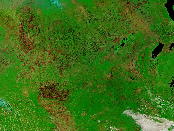
Learn how to access and use Moderate Resolution Imaging Spectroradiometer (MODIS) Version 6 land data.
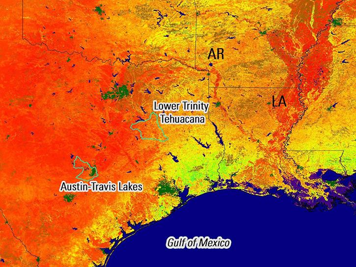
Remote sensing data's drought-indicating parameters are essential to manage the impact of water scarcities and minimize drought losses.
Soils Data Tools
| Tool Sort descending | Description | Services | |
|---|---|---|---|
| Vertex | Vertex is a graphical search interface for finding synthetic aperture radar (SAR) data. | Search and Discovery, Access, Downloading, Processing, Subsetting |
SHOWING 1 OF 1
Frequently Asked Questions
Earthdata Forum
Our online forum provides a space for users to browse thousands of FAQs about research needs, data, and data applications. You can also submit new questions for our experts to answer.
Submit Questions to Earthdata Forumand View Expert Responses