We are in the process of migrating all NASA Earth science data sites into Earthdata from now until end of 2026. Not all NASA Earth science data and resources will appear here until then. Thank you for your patience as we make this transition.
Read about the Web Unification Project
Featured Projects
NASA's Applied Remote Sensing Training (ARSET) program teaches people to use Earth-observing data in their environmental management and decision-making.

At night, satellite images of Earth capture a uniquely human signal—artificial lighting. Remotely-sensed lights at night improve our understanding of interactions between human systems and the environment.
Explore All Projects
Filters
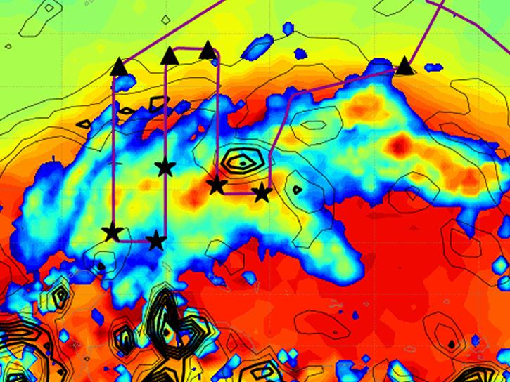
The Convective Processes Experiment - Cabo Verde (CPEX-CV) focused on studying atmospheric dynamics and marine boundary layer properties within the tropical East Atlantic region.

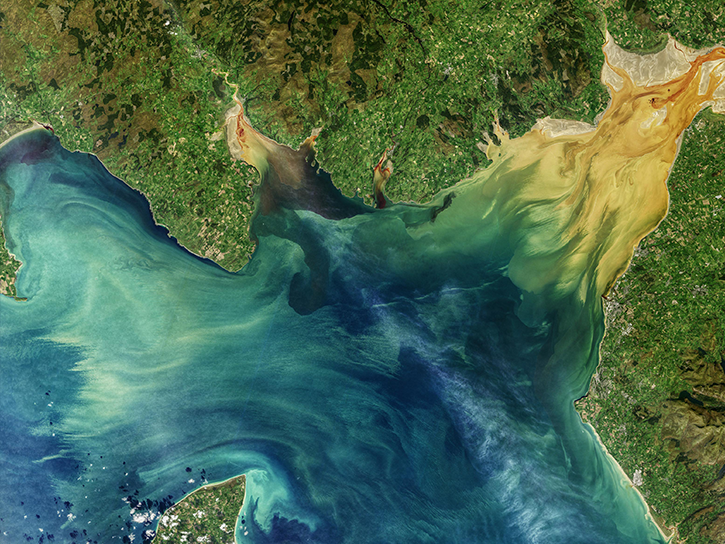
CyAN is a multi-agency project to support the environmental management and public use of U.S. lakes and estuaries by providing a capability of detecting and quantifying cyanobacteria algal blooms.

The Data Curation for Discovery team is improving the discovery of NASA Earth science data and promoting its use through interagency collaboration.
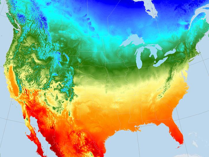
Daymet provides long-term gridded estimates of daily weather and climatology variables for North America, including Hawaii and Puerto Rico.

The DC3 field campaign sought to understand the dynamical, physical, and lightning processes of deep, mid-latitude continental convective clouds and to define the impact of these clouds on upper tropospheric composition and chemistry.

The DCOTSS field campaign was a NASA Earth Venture Suborbital research project aimed at investigating thunderstorms.
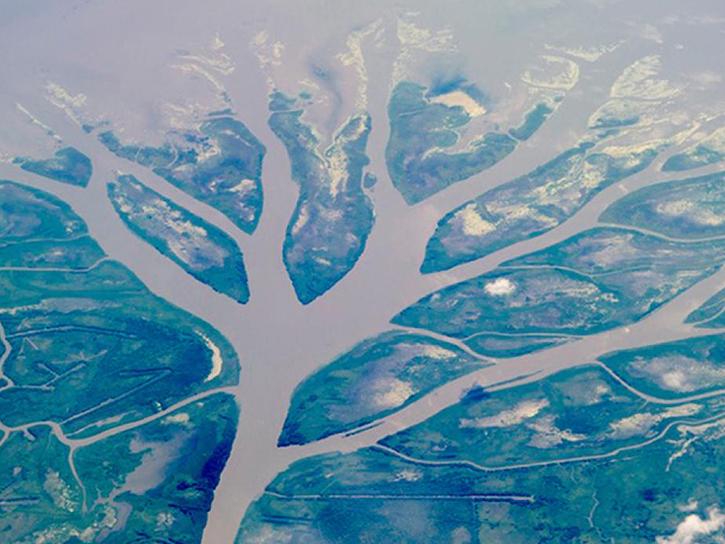
Delta-X was a five-year campaign focusing on environmental changes in the Mississippi River Delta.

The DEVOTE project investigated aerosols and clouds with the specific goals of satellite validation and the improvement of satellite data retrieval algorithms.
SHOWING 8 OF 199